|
Scenic USA - Utah Capitol Reef National Park |

| Photos by Ben Prepelka Ben Prepelka Photography |
Proclaimed a National Monument in 1937, it took another 34 years before Capitol Reef achieved national park status. Phasing out cattle grazing, purchasing remaining Mormon homesteads and annexing additional land areas proved to be the key problems that took years to mitigate.  Finally, President Nixon signed the park into law December 18, 1971. Made up of nearly a quarter million acres (378 square miles) of Utah's slickrock country, erosion continues to form Capitol Reef National Park's massive domes and cliffs, soaring spires, unique monoliths, narrow gorges, twisting canyons and impressive natural arches.
Capitol Reef is home to many unique geological highlights, especially the Strike Valley of the Waterpocket Fold. Accessible by a short hike from the end of the Upper Muley Twist Canyon, geologists proclaim the fold as one of the largest and best examples of a monocline in North American. A 100-mile long deformation in the Earth's crust, the Waterpocket Fold is Capitol Reef's most dramatic feature. Associated with an underlying fault, the fold has risen more than 7000 feet. Formed between 50 and 70 million years ago, major folds are almost always associated with underlying faults.
East of the park, area creeks and the Fremont River have carved out canyons and more of the park's towering monoliths.  The Caineville Wash Road heads north from Utah's Route 24 and guides curious sightseers off to an adventure through the slickrock countryside of Cathedral Valley.
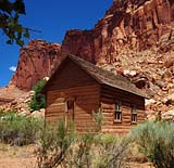
Early Mormon pioneers settled in the Freemont River Valley during the late 1870s. Never growing to more than ten families, the small community named Fruita had little contact with the outside world. One of the valley's first settlers, Nels Johnson, planted the first orchards. Groves of apples, peaches, plums, almonds and pears still stand today in the shadows of Capitol Reef National Park's towering cliffs. The park has the largest area of groves and orchards of any of the national parks with more than 3000 fruit and nut trees.
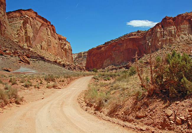
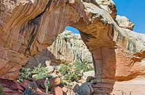
Just south of Scenic Highway 24 is Capitol Reef's Grand Wash (main photo). Here the sheer cliffs emphasize the power of erosion. After brief downpours, streams turn into torrents, carving away at soft sandstone. Runoff, laden with sand particles, is one of the primary reasons for this rapid down cutting, a process similar to sandpaper wearing away wood. Throughout the park erosional effects are responsible for the ever changing topography. During a spring thaw a significant rock fall blocked off the Hickman Bridge Trailhead. Several hundred tons of rocks, including boulders the size of a car, closed off the trail to the 133 foot Hickman Bridge. A new trail has been established for this popular hike.  Considered moderately challenging, the hike is under two miles for the round trip.
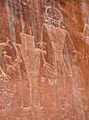
The Fremont Culture lived in the area for about one thousand years, from 300-1300 CE. The Fremont name comes from the Fremont River Canyon where they were first established as a distinct culture. Petroglyphs that were carved or chipped into the cliff walls are one of the most visible remnants of their culture today. These park petroglyph panels along UT-24 are easily seen by way of two wooden boardwalks.
Capitol Reef is certainly another spectacular example of Utah's rugged canyon country. Claiming to be two hours from the nearest traffic light, this remote park is still one of the popular stops along the Grand Circle of national parks. From Arches National Park to the Grand Canyon, southern Utah and northern Arizona offer extended stays and exciting visits to all of the incredible state parks, Navajo Tribal parks and national parklands.
Area Map

|
Additional Area Attractions |
|
Copyright © 2023 Benjamin Prepelka
All Rights Reserved
