|
Scenic USA - Utah Goosenecks Point |

| Photos by Ben Prepelka Ben Prepelka Photography |
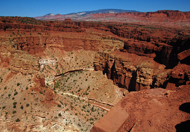
A popular stop for tour buses, Panorama Point is just two miles west of the Capitol Reef visitor center just off Route 24.  A short unpaved road leads out to Panorama Overlook and continues on to Goosenecks Point. A foot trail from the Panorama Overlook guides visitors along the canyon rim where views look down upon layer after layer of various sandstone formations. Here, the diverse geology of Capitol Reef National Park is quite evident with layers of red Wingate sandstone, a bedded Kayenta Formation and white Navajo sandstone.
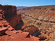
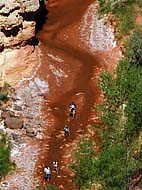
A short distance beyond Panorama Overlook, a less visited Goosenecks Point overlook is hidden behind a knoll. From the parking lot, a foot trail climbs a ridge where the path descends to the canyon rim. Carefully pick your way along the rock strewn trail, because the abrupt rim edge has few barriers between you and the 800 foot drop to Sulphur Creek below. From this view, the gooseneck displays strong evidence of the powerful forces of relentless river currents. Voices rising up from an unseen group of hikers may give the impression that this grand view is somehow playing tricks on your mind, and is not as immense as it looks.  But, the hikers are well out of range for the human eye. Powerful optics clearly pick up a line hikers trudging through the river bottom, giving credence to statement that Capitol Reef has some of the clearest air in Utah.
The Sulphur Creek hike is one of the best in Capitol Reef National Park and is usually attempted during summer months. Having a moderate flashflood potential, hikers are cautioned to check local weather forecasts and talk with park rangers at the visitor center before entering the canyon. Although the cool water is refreshing on a hot summer day, its appropriate name hints that Sulphur Creek is not something you would drink. Hikers are advised to bring enough water to last throughout this half day hike. The trailhead begins at the Chimney Rock parking lot and requires some type of transportation back to your vehicle at the end of the hike.
Area Map

|
Nearby Points of Interest |
Scenic USA Prints from
|
Copyright © 2022 Benjamin Prepelka
All Rights Reserved

