|
Scenic USA - New Jersey Sandy Hook |

| Photos by Ben Prepelka Ben Prepelka Photography |
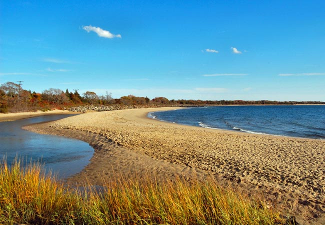
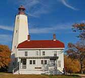
Capping off 130 miles of New Jersey shoreline, Sandy Hook stretches northward six and a half miles from the mainland.  This fragile barrier island began as a small shoal, extending out from Long Branch. Wave action along the Jersey coast produces a northward long-shore current, carrying tons of sand every day. Over several millennia these currents and littoral drift lengthened Sandy Hook into today's barrier island. When the Sandy Hook Lighthouse was completed in 1764, it was 500 feet from the tip of the hook. Today, the lighthouse is a mile and a half from the ever growing northern end of Sandy Hook.
Today the Sandy Hook Unit of the Gateway NRA, governed by the National Park Service, offers beachgoers, birdwatchers, and anglers miles of open Atlantic beaches. A multi use pathway begins at the park entrance and ends near the tip at Fort Hancock. Skaters, bicyclists and walkers share this 5 mile paved path.  Plum Island, Spermaceti Cove, North Pond and the Horseshoe Cove Salt Marsh are prime areas for birding. For history buffs, Fort Hancock NHS, Battery Gunnison, Officer's Row and the Sandy Hook Lighthouse are open with extended hours from Memorial Day to Labor Day. Because of Sandy Hook's position on the southern side of a major shipping channel into New York Harbor, the Sandy Hook Lighthouse was one of the first sentinels on the coast. The lighthouse, dating back to 1764, is the nation's oldest light station remaining in continuous service.
Area Map

|
More Area Attractions |
Scenic USA Prints from
|
Copyright © 2019 Benjamin Prepelka
All Rights Reserved

