|
Scenic USA - California Death Valley Scenic Byway |

| Photo by Neil Marcus Neil Marcus Photography Inset photos Ben Prepelka |
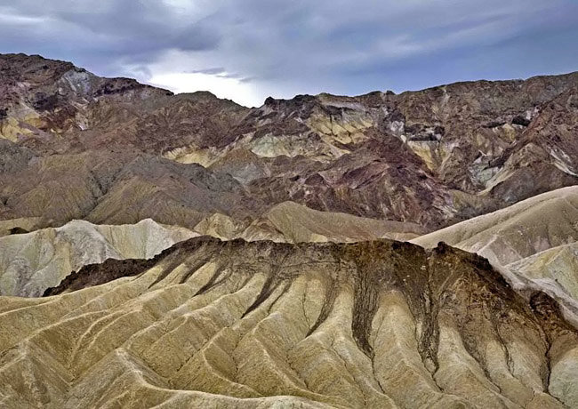
A catchy 1907 advertisement promoted Death Valley with  a line about enjoying a trip into hell with all the advantages and none of the inconveniences. Today, the Death Valley Scenic Byway introduces California sightseers to this earthly hell and over three million acres of forbidding, parched desert landscapes. Its badlands are a maze of highly eroded canyons and prehistoric lakes of mudstone, all shaped by sporadic rainfall and high winds. With nothing to absorb heavy rain, water immediately rushes downhill, creating rills, deep gullies and all the interesting features that made Death Valley famous.
This popular Death Valley National Park viewpoint takes  in Zabriskie Point, located east of Furnace Creek on Route 190. Here, wildly eroded hills show off an artist's palette of colors, especially enhanced with sunrises and sunsets.
The Death Valley Scenic Byway covers 265 miles and counting stops, may take more than a day to see all the highlights and scenic vistas. Also in the Furnace Creek Area you'll find the Borax Museum, the Harmony Borax Works Trail and Furnace Creek Ranch. The Rhyolite Ghost Town, just outside Death  Valley National Park boundaries, is one site that's worth a little side trip. The western end of the byway, surrounded by high mountain ranges, offers a dramatic contrast to wide open dry lake beds. Here, Father Crowley Point offers views from atop the Argus Mountain Range. Further east, the dunes at the Stovepipe Wells lend to another photo opportunity, where dune tracks seldom last more than a day. Scotty’s Castle and the Wildrose Charcoal Kilns are a few more interesting man-made features on the byway.
Byway Map

|
More Points of Interest |
|
Copyright © 2022 Benjamin Prepelka
All Rights Reserved
