|
Scenic USA - California Golden Canyon |

| Photos by Rob Jones Rob's Death Valley Trip Report |
Death Valley's vast and desolate land may be frightening or intimidating to its newcomers, but in time hikers grow accustom to its austere landscape and come away with a deeper appreciation of this huge desert.  Most park trails are cross-country, semi-marked, and follow ridges and traverse canyons. As you may imagine, summertime is not the best time to attempt any Death Valley hiking. When high temperatures begin to ease in the late fall, hikers set off to experience a freedom and solitude found nowhere else.
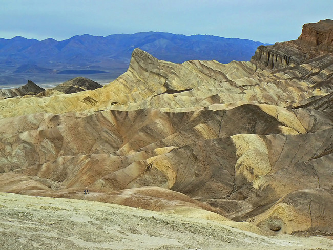
One of the easiest Death Valley hikes is found in the colorful Golden Canyon. Located just south of Route 190 on Badwater Road, the Golden Canyon Interpretive Trail is a great introduction to the desert landscape. This two mile roundtrip wanders through an ancient desert of alluvial fans, rocky canyons and deep deposits of sand, silt, gravel and cobbles.  Heavy rains have little chance to soak into the impermeable clay and rocky ridges. Steep slopes, numerous gullies and ravines only magnify the swift floodwaters.
  Unable to gain a foothold in this dynamic landscape, the desert here is nearly devoid of plants.
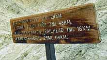
Once covered in a shimmering lake, hikers may observe fascinating fossils, well preserved sand ripples, and a variety of mineral deposits which include salt, sulfur, borax and gypsum. Hikers eager to explore more of this area have several options. Golden Valley connects with the Zabriskie Point, the Gower Gulch Loop and Red Cathedral. Hikers are always cautioned to bring plenty of water and make sure they drink even before they become thirsty. Solitude is the norm in Death Valley's backcountry, and hikers should be familiar with their limits and degree of self-reliability.
Trail Guide and Map
GC Trailhead - south of Furnace Creek Visitor Center on Badwater Road

|
Additional Area Attractions |
|
Copyright © 2020 Benjamin Prepelka
All Rights Reserved
