|
Scenic USA - Texas Hill Country Trail |

| Photos by Ben Prepelka Ben Prepelka Photography |
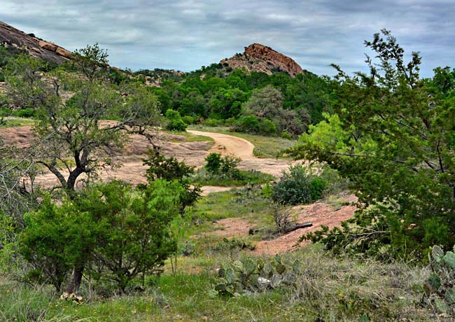
Heading west from the capital city of Austin, Texas Hill Country stretches  across the heart of Texas. Once a seabed of limestone, the region buckled upward into today's Hill Country landscape, creating wave upon wave of rolling hills. Here, the heartland is made up of 19 counties, all contributing to the rich culture, heritage and scenic beauty of Texas.
Taking the Texas Hill Country Trail, a 415 mile scenic byway, is a great way to experience the beauty of the Edwards Plateau while enjoying Texas town hospitality. For some, plans may include exploring many of the region's limestone caverns. Other summer travelers may be set to cool off in one of the many spring fed rivers.
Here in the Texas Hill Country rivers are fed by area springs as they meanders through the hills. These scenic rivers, such as the Frio,  the Medina, Guadalupe, Blanco, and Nueces, are fed by water that is filtered through pure limestone, flowing out crystal clear and very cool. The northern section of the Texas Hill Country Trail wanders through the Deer Capital of Texas, over rolling hills of springtime bluebonnets, and into the historic city of Austin.
Texas  is huge ... and although Texas Hill Country is just a small section of the state, it's best to plan on a period of days to enjoy this byway and all its attractions. The Hill Country brochure details all the regionís towns, their history, and many of the area's attractions. The brochure also lists the regionís 14 state parks and natural areas, plus information on its national historic sites. The Texas Historical Commission invites you to explore the mystique of central Texas.
Byway Map
Hill Country Map

|
Byway Attractions |
Scenic USA Prints from
|
Copyright © 2025 Benjamin Prepelka
All Rights Reserved

