|
Scenic USA - South Carolina Jocassee Gorges |

| Photos by Ben Prepelka Scenic USA FAA Photography |
Marking the abrupt end of the South Carolina piedmont, the Jocassee Gorges area runs parallel to the North Carolina border and climbs 2000 feet in just a few miles. Known as an escarpment to geologists, this rugged area is carved up by eight major streams, creating the gorges in this wilderness land. During the past century the area was managed by the timber industry until Tommy Wyche, John E. Frampton, and Dr. James A. Timmerman gathered enough interest from conservation groups and foundations to buy nearly 50 square miles of this unique and diverse land.
Known as the Place of the Lost One to American Indians, the Jocassee region has attracted the scientific community since the late 1700s. The Jocassee area, one of the last sites for the extinct Carolina parakeet, also fascinated botanists William Bartram and Andre Michaux.
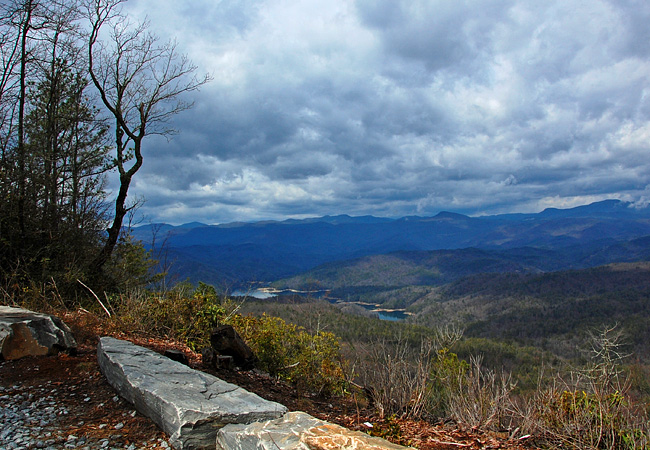
Positioned among other conservation lands,  an extensive road system and network of hiking trails provide anglers, hunters and backcountry hikers a unique opportunity to explore the Blue Wall. Here along Horse Pasture Road, an old lumbering access trail, views of the Blue Ridge Mountains extend clear into North Carolina. Below lie the crystal clear waters of Lake Jocassee, a playground for South Carolina boaters, anglers and watersport enthusiasts.
Thanks to the many generous partners, including Duke Energy, Clemson University and the Mellon Foundation, Jocassee Gorges Management Area provides protection for over 43,000 acres and a public recreation area that's compatible with the natural character of this rugged land.
Area Map
Preserve Map

|
Additional Points of Interest |
Scenic USA Prints from
|
Copyright © 2021 Benjamin Prepelka
All Rights Reserved

