|
Scenic USA - Utah Shafer Trail |

| Photos by Ben Prepelka Ben Prepelka Photography |
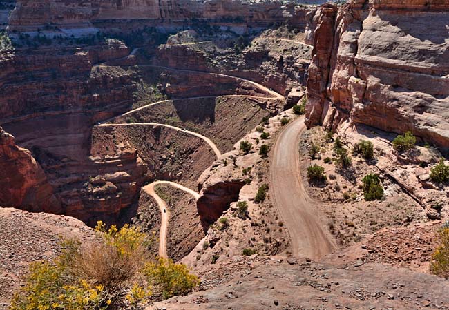
What goes up, must come down! Well ... in this case, driving up Shafer Trail in Canyonlands National Park is much less frightening than attempting to descend.
Divided up into three different sections, or districts, Canyonlands National Park is packed full of scenic wonders. Just south of Moab, a broad mesa lies between the Colorado and Green rivers. This wedge shaped section of land features the
Island in the Sky District and offers some grandest views of big river canyons as well as some the easiest ways to explore  the Canyonlands. While the Needles District and the Maze offer many more miles of backcountry foot-trails, the Island in the Sky is laced with 4-wheel-drive roads.
Shafer Trail winds its way up (or down) a 1500 foot sheer-walled mesa cliff using a path with multiple switchbacks and hairpin turns. This old mining trail, with grades as steep as 16 percent, is one of the many exciting
four-wheel-drive routes in the park. The 18 mile route is not recommended for sissies. Described as extremely challenging, ego crushing and heart stopping, this is the route where Thelma and Louise drove their car off the cliff edge. The view shown here is from an area within Canyonland National Park, but the road continues for almost 20 miles until it reaches UT-279.
Area Map

|
More Areas of Interest |
|
Copyright © 2022 Benjamin Prepelka
All Rights Reserved
