|
Scenic USA - Nevada Lower Lee Meadows |

| Photos by Meri Cheatham |
Southern Nevada's tallest peak, Mount Charleston, is located in the cool  Spring Mountains National Recreation Area about 20 miles out of Las Vegas. Part of the Humboldt-Toiyabe National Forest, this snow capped range offers a refreshing change of scenery from the flat Mojave valley which surrounds Las Vegas. The Spring Mountains were formed of sedimentary rock that's been folded, faulted and uplifted over time. Rain and snowmelt percolates through this porous and fractured rock, leading to over 100 springs and creating a name for this southern Nevada mountain range.
 When Nevada routes 157 (Mt. Charleston/Lee Canyon Road), 158 (Deer Creek Road),
and 156 (Lee Canyon Road) are coupled together, the trio creates a wonderful scenic loop and a pleasant respite from the desert heat. This 36 mile drive quickly turns from desert views of sagebrush and yucca to green mountains of white fir and pinyon pine. The scenic loop winds through the Spring Mountains National Recreation Area, a 316,000 acre forest area of tall peaks and deep canyons, remarkable beauty and areas of abundant wildlife.
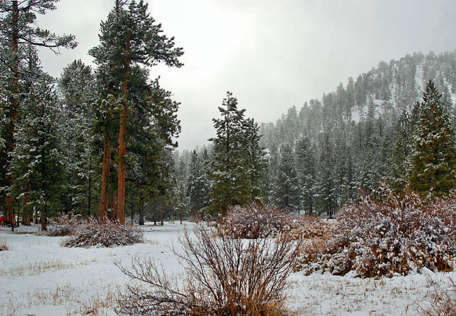
Pictured here is an unusual scene of Lower Lee Meadows caught in an early snowfall. During the spring and summer the meadow area is bathed in wildflowers, making a welcome sight for hikers, campers and picnickers.
Area Map

|
More Area Attractions |
|
Copyright © 2024 Benjamin Prepelka
All Rights Reserved
