|
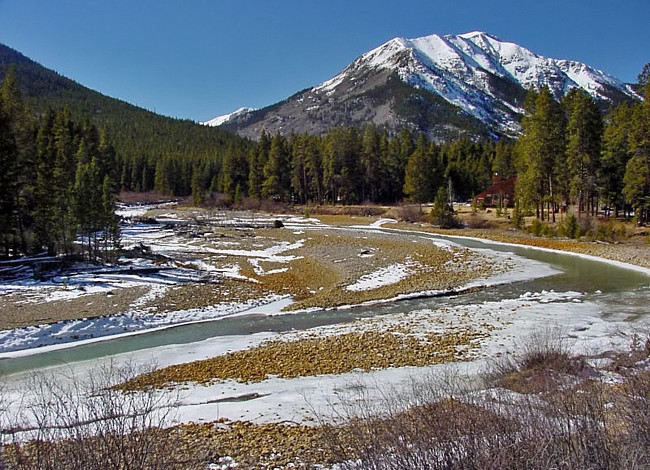
Scenic USA - Colorado Roaring Fork River |

| Photo by Marilyn Porter |
Colorado's Route 82, connecting Leadville and Aspen, climbs through one of state's highest mountain passes. To illustrate what it takes to make it over the pass, trucks are forbidden, and hairpin turns and switchbacks are so tight speed limits drop to 10 mile per hour. Heading west, this southern section of the Top of the Rockies Byway rises over the Sawatch Range at Independence Pass, showing off some of the awesome views of Colorado’s 14ers. Off to the north is Colorado’s highest peak, Mount Elbert. To the south of the pass, the Roaring Fork River gets its start.
Known as the Thunder River to the Ute Indian Tribe, the Roaring Fork River lives up to either one of its names. Although this beautiful view doesn't show a close-up of the river's power, the Roaring Fork drops over 6800 feet over its 70 mile course. Joined by more crystal clear mountain streams, mostly the Frying Pan River and Crystal River, the Roaring Fork eventually meets the Colorado River at Glenwood Springs.
When torrents from early summer's snowmelt ease, Roaring Fork River rivals any trout stream in America. Famous for its lengthy green drake hatch, diehard anglers try to plan their trip to Colorado at the peak. Before the river slows, the thundering river provides some of the most exciting kayaking and whitewater rafting for beginners. Through Snowmass Canyon, intermediate rafters will find excitement taking on Sledgehammer and Toothache rapids. Whether you're here to enjoy fishing, rafting or sightseeing, this river route is never short on Colorado's grand scenery.
Area Map

|
Additional Area Attractions |
|
Copyright © 2024 Benjamin Prepelka
All Rights Reserved
