|
Scenic USA - Arkansas Beaver Lake |

| Photos by Ben Prepelka Ben Prepelka Photography |
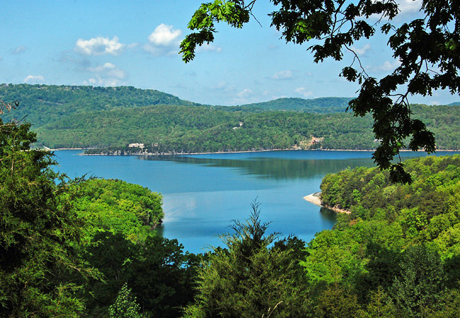
Beaver Lake was initially built to provide flood control along the White River about 50 years ago,  but today it provides an excellent recreation setting. Defined in the Flood Control Act of 1944, the Beaver Dam held back the floodwaters of the White River and Missouri's Table Rock Lake, creating a 50 mile long lake in the Ozarks. Spreading out into four Arkansas counties, Beaver Lake is a nature lover's paradise. Surrounded by mountains, towering limestone cliffs, rock shelters and a thick Arkansas forest, this gem in the Ozarks features 12 recreation areas, complete with campgrounds, picnic areas, swimming beaches, hiking trails and boat access.
A wide range of activities are offered in the Beaver Lake area, including scuba diving, spelunking, water sports and sightseeing. With 450 miles of shoreline, you can easily guess the main draw is boating and fishing.  Seven full service marinas and 28 boat ramps facilitate boaters throughout the 28,000 acre lake. Home to eight major fishing tournaments, anglers seek out smallmouth, largemouth, white and hybrid bass, plus spoonbill catfish, brim, crappie and trout. With bone chilling dam-releases, record-sized German brown trout and rainbows hang out just below the dam. Just mention 40 pound-plus stripers and anglers are eager to see if they can secure a place in the state record books.
Area Map

|
Additional Area Attractions |
Scenic USA Prints from
|
Copyright © 2020 Benjamin Prepelka
All Rights Reserved

