|
Scenic USA - Connecticut Buttermilk Falls - Terryville |

| Photos by Ben Prepelka Scenic USA FAA Photography |
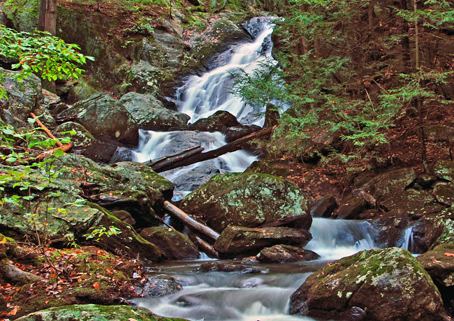
Very often waterfall web sites list roadside attractions that sound easy to locate. Every once in a while this proves to be more challenging than hiking out to a waterfall. Getting to Connecticut's Buttermilk Falls, located on the Mattatuck Trail, is one of those waterfall sites that looks easy on paper, but offers a bit of a challenge in following directions.
Here in Litchfield Hills region, the blue blazed Mattatuck Trail weaves in and out of a mixture of forest land, suburban neighborhoods, wetlands and rocky terrain. Following a general southeast direction from Litchfield to Wolcott, the 38 mile trail passes through the Buttermilk Falls area. For the casual sightseer, picking up a driving route from the intersection of South Main and Lane Hill Road (south of Terryville), Lane Hill Road climbs toward Allentown Road. Within a tenth of a mile an indistinguishable pull-out on Lane Hill Road marks the trailhead out to the falls. A short trail crosses a wooden footbridge and through a forest of hemlocks to this roadside attraction.  Governed by the Nature Conservancy, the beautiful 55 foot cascade is definitly one of Connecticut’s hidden gems.
Beginning with a gift of 723 acres in 1926, Connecticut's Mattatuck State Forest has grown to encompass 4510 acres in 20 different parcels throughout the towns of Waterbury, Plymouth, Thomaston, Watertown, Litchfield, and Harwinton. Since Harley F. Roberts' original gift of land 85 years ago, many have benefited from his vision of land conservation. The well managed Mattatuck State Forest is still used for forest products and wildlife habitat, as well as offering miles of rugged trails for hiking and hunting.
Area Map

|
Additional Points of Interest |
Scenic USA Prints from
|
Copyright © 2019 Benjamin Prepelka
All Rights Reserved

