|
Scenic USA - Oregon Mount Hood Scenic Byway |

| Photos by Alastair Allan Alastair Allan Photography |
Oregon's Mount Hood Scenic Byway begins following U.S. Route 26 along the Sandy River from Wood Village near the Columbia River.  The byway then turns northward on Route 35, and heads back to the city of Hood River and the Columbia River Gorge. This 105 mile journey circles around Oregon's iconic landmark Mount Hood. The 11,245 foot high Mount Hood, a dormant volcanic peak, is the fourth highest in the Cascade Range, and the state's tallest peak. Major eruptions have occurred over the last 15,000 years with the most recent just before the arrival of Lewis and Clark in 1805.
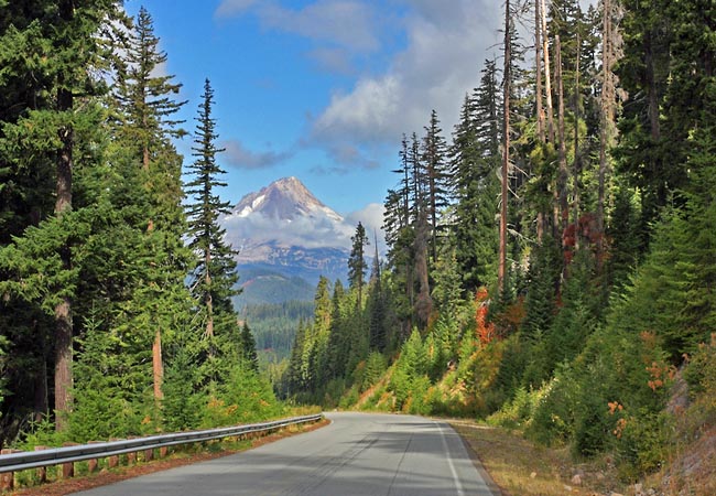
This scene of Mount Hood through the evergreens reminds us that Oregon is covered in a rich forestland just as its northern neighbor Washington, the Evergreen State. These heavily forested foothills lead down to the fertile bottomlands and valleys created by the Hood River.  The byway, beginning with city views and shops near I-84, steers visitors through farm country, where wineries, orchards and nurseries are spread throughout the lush valley. The area boasts of year around recreation, with snow skiing, golfing, hiking and windsurfing taking center stage.
Over the last century visitors have retreated to the Hood River Valley's towns and villages for rest and relaxation. The Resort at the Mountain has entertained guests since the late 1800s. Today, accommodations along the byway vary from the quaint log cabins on the river, to modern condos loaded with amenities. Although it may take less than two hours to drive the 85 mile byway, its scenic sights and attractions may take more than a day to explore ... so you may want to plan on a place to spend the night.
Area Map
Byway Map

|
Additional Area Attractions |
|
Copyright © 2020 Benjamin Prepelka
All Rights Reserved
