|
Scenic USA - Wyoming Bighorn Scenic Byway |

| Photos by Ben Prepelka Ben Prepelka Photography |
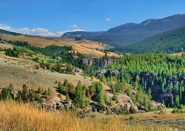
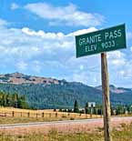
The town of Dayton signals to westbound U.S. Rt. 14 travelers that they're headed toward the eastern edge of the Great Basin Plains of Wyoming. But just ahead lies the very imposing Bighorn Mountains, a sister range of the Great Rockies. U.S. Route 14 weaves its way through the foothills, then climbs into the steep mountain range toward Granite Pass. This scenic route leads through alpine meadows and the Bighorn National Forest. The vast forestland covers over a million acres, dotted with lodgepole pines and boasts mountain peaks over 13,000 feet.  The Bighorn meadows are where sightseers may spot elk and bighorn sheep during the summer. Forest mammals include coyotes, snowshoe hares, red squirrels, and marmots. Hikers should keep in mind that there are occasional sightings of mountain lions and black bear.
When American Indians spoke about the area, topics included great herds of bighorn sheep. Not fully understanding the Native tongue, Lewis and Clark transformed the bighorn name to the entire mountain region.
Welcome to the Bighorn Scenic Byway ! This 70 mile route rises nearly 6000 feet from the valley near Dayton to the high point at Granite Pass. A breathtaking drive, the highway connects vacationers and sightseers from the Black Hills in South Dakota to Yellowstone National Park in northwest Wyoming. Varying from the natural attractions of the Tongue River Canyon and Shell Falls to Country’s #1 Western Town, Sheridan, the byway offers plenty for the entire family to enjoy.
Byway Map

|
More Area Attractions |
|
Copyright © 2024 Benjamin Prepelka
All Rights Reserved
