|
Scenic USA - Wyoming Cloud Peak Skyway |

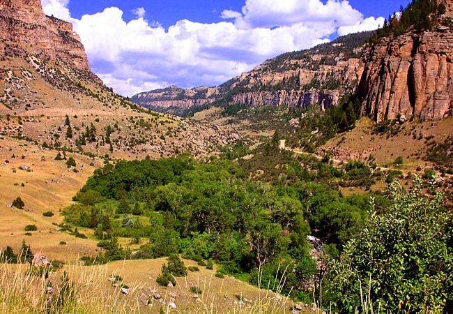
| Photo by Ron McEwan |
One of Wyoming's 22 scenic byways, the 64 mile Cloud Peak Skyway follows Route 16 from Fort McKinney to the town of Tensleep. The byway takes the name of a nearby wilderness land and weaves 47 miles through the rugged lands of the Bighorn Mountains. Topping out at Powder Pass (elevation 9,666 feet), the Skyway crosses the "backbone" of the Bighorns. Here the scenery is spectacular, and pullouts offer a chance to catch your breath and enjoy the view. Cloud Peak, the "granddaddy" of the Bighorn Mountains, can only be seen from this route.
This scene is found just outside of Ten Sleep, a view into Tensleep Canyon. The highway is quite modern since its first debut in 1920. But even today, the "white knuckle" twists and turns and steep grades give testimony to the tenacity of the first travelers following this scenic highway. For those heading east, Tensleep was a "last chance" town until travelers arrived in Buffalo. After all the talk of Tensleep, one has to wonder about the name. For the curious, the name comes from the Sioux, as the foothills area of the Bighorns was ten nights between camps.
Other notable stops along the byway include Medicine Lodge State Archaeological Site, and Cloud Peak Wilderness. Hikers will find plenty of opportunities to explore the region at Tensleep Preserve and throughout the Bighorn Mountains.
Area Map

Copyright © 2020 Benjamin Prepelka
All Rights Reserved
