|
Scenic USA - Oklahoma Black Mesa State Park |

| Photos by Ben Prepelka Ben Prepelka Photography |
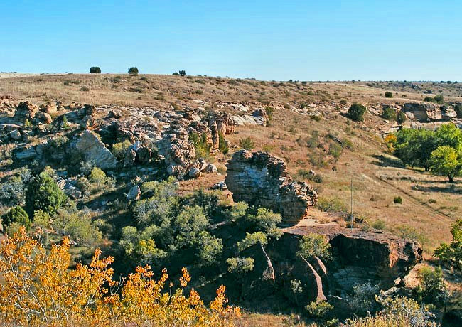
While scanning the horizon from Oklahoma's Black Mesa State Park there's a good chance of spotting the highest point in the state.  Just 14 miles to the north, the park's namesake stretches across the horizon. Black Mesa follows the Cimarron River for 28 miles, beginning in Colorado, crossing the northeast corner of New Mexico and on into the Oklahoma panhandle. The sprawling mesa was formed of volcanic rock, erupting from a vent in the Raton-Clayton volcanic field less than five million years ago. A challenging four mile hike leads to the top of the mesa, nearly 5000 feet in elevation.
Part of the Great Plains Trail, the area is noted for its wildlife, as well as ancient fossilized plants and animals embedded in a six hundred foot thick lava bed. Here in today's arid prairie environment, typified by grasslands and rocky buttes, wildlife sightings include the Texas horned lizard, mountain lions, bobcats, pronghorn, black bears, bighorn sheep, nine species of snakes and dozens of bird species.
Black Mesa State Park, also covered in a layer  of black lava, takes in 350 acres of this rugged terrain. The park, located in the extreme northwest corner of the state, offers 56 campsites, RV sites, and a large group campsite. Recently stocked with largemouth bass, sunfish and channel catfish, the 160 acre Lake Carl Etling provides an ideal spot for fishing and swimming. Enticing the angler, the lake is stocked from November through April. Two hiking trails are located within the park. The rather easy Black Mesa Bird Haven Trail covers about a quarter mile. The more advanced Mesa Vista Trail, nearly a mile in length, follows the rugged bluff-line and is labeled moderately difficult.
Area Map

|
More Area Attractions |
Scenic USA Prints from
|
Copyright © 2023 Benjamin Prepelka
All Rights Reserved

