|
Scenic USA - Illinois Ohio River Scenic Byway |

| Photos by Ben Prepelka Ben Prepelka Photography |
The southern tip of Illinois is oddly shaped by its border rivers, especially by the meandering Ohio.  Bordering Kentucky, this land is thickly wooded and sometimes referred as the Illinois Ozarks. These are the Shawnee Hills, a large section of national forestland that butts up to the Ohio River Valley. Illinois Route 146 follows along the gentle curves of the Ohio River, passing the Smithland Locks and Dam, the Cache River State Natural Area, Kincaid Mounds Archaeological Site, and Mound City National Cemetery and Visitor Center. Other highlights of the Ohio River Scenic Byway include the historic towns of Golconda and Elizabethtown, the Cave-in-the-Rock, and
Fort Massac State Park
  .
.
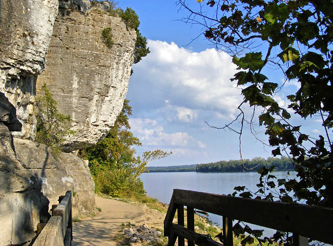
Inland, in the midst of the 270,000 acre Shawnee National Forest, byway travelers may enjoy Pounds Hollow Recreation Area, Dixon Springs State Park, Saline Company Conservation Area and a fanciful rock collection found in the Garden of the Gods. This cliff-side scene was found in
Cave-in-the-Rock State Park overlooking the Ohio River. The 160 foot cave is deeply carved into the river bank's limestone bluff, an enticing niche to explore. Once a hang-out for river pirates, the cave is now one of the popular landmarks in this 200 acre state park.
While the byway may take about three hours drving time, expect to spend a few days exploring the parks, small towns and historic landmarks.
Byway Map

|
More Area Attractions |
|
Copyright © 2023 Benjamin Prepelka
All Rights Reserved
