|
Scenic USA - Montana Kootenai River |

| Photos by Jim Hug Jim's Big Sky Fishing |
At one time this wild river, swollen with early summer snow melt and rain, ran free and ripped through northern Montana from its origin north of the Canadian border at Kootenay National Park. The Kootenai River's strong currents and unyielding waters created numerous broad river valleys and deep gorges. Today, the river is held in check by Montana's Libby Dam, creating Lake Koocanusa which backs up into British Columbia. The river, named for the nearby Kootenai people (Kitunahan), still experiences fluctuations in water flow, but often allows for a leisurely  rafting, canoeing or kayaking float trip for 20 miles below Jennings Rapid. A few exceptions southward are the China Rapids, Kootenai Falls (a 30 foot drop), and a two mile gorge where only the experienced should chance the thrill.
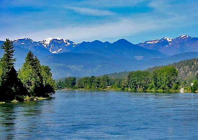
Downstream, defying logic, the 485 mile river does a U-turn and heads northward through Idaho and back over the border into British Columbia. Pictured here is a section of the upper Kootenai, where snowcapped peaks add to the wonderful Montana scenery. Anglers and floaters, enjoying the beauty of the north country, are reminded to seek advice on current river conditions, especially during dangerous peaks of high water.
Area Map

|
Additional Area Attractions |
|
Copyright © 2020 Benjamin Prepelka
All Rights Reserved
