|
Scenic USA - Oregon Latourell Falls |

| Photos by Ben Prepelka Ben Prepelka Photography |
Heading eastward from the Portland area, travelers find that the Columbia River has managed to cut the only sea level route through the Cascade Mountain Range. And a spectacular gorge it is! Slicing through thick Columbia River basalt, the gorge is 80 miles long and up to 4000 feet deep. Creating a border between the states of Oregon and Washington, the Columbia River Valley can be viewed from scenic highways that follow along each side of the river. Roadside attractions on these routes include orchards and wineries, historic landmarks, scenic overlooks, state parks and over 70 waterfalls.
While Multnomah Falls grabs the most attention, a handful of roadside waterfalls offer more excitement on your Columbia River Gorge road  trip.
trip.
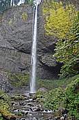
Just out of sight from the Columbia Gorge Scenic Highway, Latourell Creek drops 214 feet over a shear, moss covered cliff. A few short footpaths from the highway lead to either an open viewpoint or down to the base of the falls. The falls is part of the  Guy W. Talbot State Park, named for the generous former landowner.
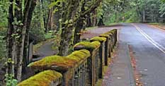
Ambitious hikers may take a 2.5 mile loop hike further into the park. This trail leads around the lower basin and climbs to the upper Latourell Falls. With thick green moss and long leafy ferns covering just about everything that remains in the shade, the picnic area below Latourell Creek Bridge is a great rest stop to enjoy all park's flora and fauna.
Area Map

|
More Area Attractions |
Scenic USA Prints from
|
Copyright © 2025 Benjamin Prepelka
All Rights Reserved

