|
Scenic USA - Tennessee Sewanee Natural Bridge |

| Photos by Ben Prepelka Ben Prepelka Photography |
Between Chattanooga and Knoxville, I-75 follows alongside some of the highest and most rugged terrain of the Appalachian Mountains. Mirroring the interstate, Wallings Ridge appears as another barrier to the west, marking the eastern edge of Tennessee's Cumberland Plateau. This rather large plateau is sparsely covered with a few back country roads solely because of its remote location and rugged topography. Its sheer cliffs and rugged canyons (gulfs) give the northern section of the 15,590 acre South Cumberland State Recreation Area the name of Savage Gulf. Broken into nine districts, South Cumberland SRA is scattered over 100 square miles and four counties, all accessed over 80 miles of hiking trails.
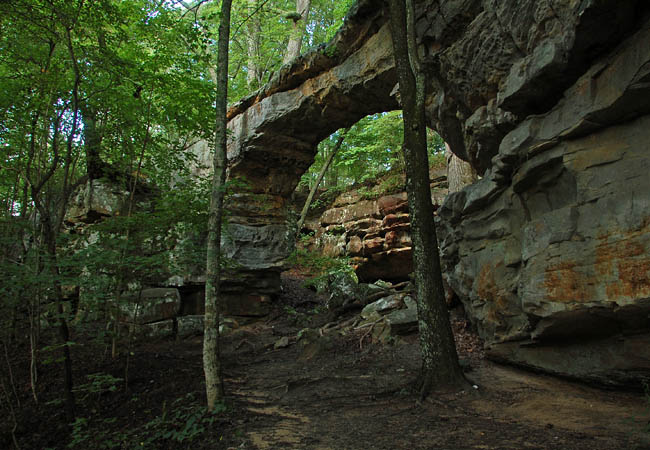
Not far from I-24 in Franklin County, visitors may easily find the southwestern district of South Cumberland SRA's Sewanee Natural Bridge State Natural Area. This small section of the parkland features a 50 foot long sandstone natural bridge. A walk across the bridge, over a 25 foot high opening, offers a good look at the Lost Cove area below. A wet weather spring was most likely the creative force behind the bridge formation. Other small holes through the cliffs offer a good idea of how natural bridges evolve. Tennessee's cold winters also play a part in bridge formation, as frost wedging is another method of mechanical weathering which chips away at the sandstone layers.
Just a short walk from the parking lot, a well worn path leads to the natural bridge. Although this may have all the features of a family hike, a cautionary note reminds everyone this is a natural setting without bridge handrails and involves steep slopes. Beyond the natural bridge, day hikers will discover where Lost Creek disappears into Lost Cove Cave in the Big Sinks area.
Area Map

|
More Area Attractions |
Scenic USA Prints from
|
Copyright © 2024 Benjamin Prepelka
All Rights Reserved

