|
Scenic USA - New Mexico Chaco Canyon Ruins |

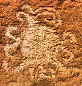
| Photos by Ian Parker Ian Parker Photgraphy Petroglyph image courtesy of NPS |
Located in a remote northwest corner of New Mexico's high desert is one of the most  exceptional concentrations of ancient Puebloan dwellings in the Southwest. Halfway between Farmington and Albuquerque lies the Chaco Culture National Historical Park, preserving 15 major complexes and nearly 4000 archeological sites. Beginning around 850 CE, Chaco Canyon was the center of a thriving culture for over 300 years. With no written records, Chacoan history is pieced together from hundreds of discarded fragments in a trash heap.
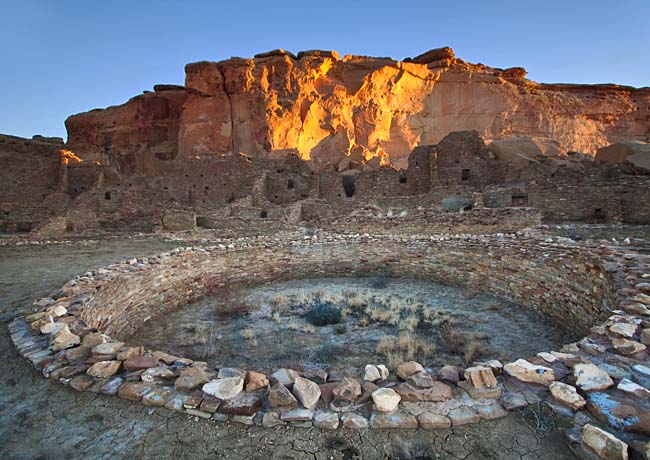
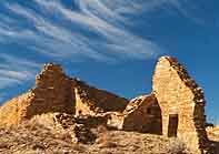
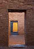
The only way to appreciate this  incredible collection of dwellings, kivas and the Great House is a visit to the ruins found along the 9-mile Canyon Loop Drive. The park road provides access to five major Chacoan sites, including Una Vida, Hungo Pavi, Pueblo Bonito, Chetro Ketl, Pueblo del Arroyo, and Casa Rinconada. These intriguing ancestral Puebloan sites are open from 7am to sunset, where moderate gravel pathways lead out to the Chacoan structures. Chetro Ketl, about four and a half miles from the visitor center, is the second largest Chacoan great house and covers more than 3 acres. Constructed in stages from 850 CE to 1150 CE, Pueblo Bonito rose to four or five stories high and most likely housed 1200 people. Center of an ancient world, Pueblo Bonito (pictured here) is the most important site in the canyon and a must see for all visitors.
Although the main draw to this park is the intriguing sandstone dwellings, some time should be devote to the exploration of Chaco Canyon.  With a high desert-like climate, the area sees no more than ten inches of annual rainfall. Despite the harsh conditions, the canyon supports elk, deer, bobcats, rabbits, badgers, porcupines, bats, snakes, lizards and a diverse bird population.
The canyon floor, once cut by the Chaco Wash, has slowly been accumulating alluvium fill over the last 40,000 years. Surrounded by seemingly endless sandstone mesas, small side canyons (rincons) appear as slices into the high cliff walls. This Four Corners Region, home to today's Hopi and Navajo tribes, has always been plagued by sparse rainfall. But a 50 year drought, beginning in 1125 AD, is thought to have been one of the factors that ended this thriving Chaco Canyon community.
Area Map
Park Map

Directions: From the north, turn off US 550 at CR 7900--3 miles southeast of Nageezi and approximately 50 miles west of Cuba (at mile 112.5). This route is clearly signed from US 550 to the park boundary (21 miles). The route includes 8 miles of paved road (CR 7900 & CR7950) and 13 miles of rough dirt road (CR7950). The 4 1/2 miles before entering the park are very rough.
|
Additional Area Attractions |
|
Copyright © 2022 Benjamin Prepelka
All Rights Reserved
