|
Scenic USA - South Dakota Castle Rock Butte |

| Photos by Ben Prepelka Ben Prepelka Photography |
The Great Plains of North American stretch across the western regions of the continent from Mexico, through the United States into Canada. America's Great Plains conjure up old images of wagon trains and pioneers plodding across a treeless grassland. Viewed as a semi-arid land, nearly all the Great Plains, east of the Rockies to the Mississippi River, receive less than 24 inches of rainfall a year. Most of the region's trees tend to cluster along river valleys and floodplains, with a few distinctive exceptions in South Dakota’s Black Hills and the central Texas Pineywoods region. 
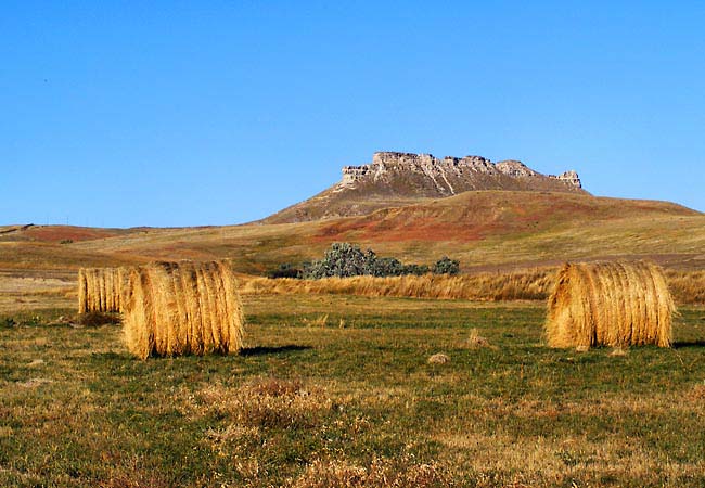
This view captures Castle Rock Butte as it reaches a 3740 foot highpoint above South Dakota’s High Plains. Located near the geographic center of the United States, Butte County was named for its numerous buttes that can be seen for miles in this wide open expanse. Protected by a tough layer of cap rock, Castle Rock Butte has resisted incessant, unchecked prairie winds for the last 10,000 years. Once a grazing ground for great buffalo herds, today’s grasslands continue producing hay and provide pastureland for cattle. Often discounted as drab and lifeless, this South Dakota High Plains scene offers an impressive openness, and possibly its overwhelming enormity and vast wave-like hills may bring on a sense of one’s insignificance.
Area Map

Copyright © 2020 Benjamin Prepelka
All Rights Reserved

