|
Scenic USA - Oregon Steens Mountain Loop |

| Photos by Denny Barnes Denny Barnes Photography |
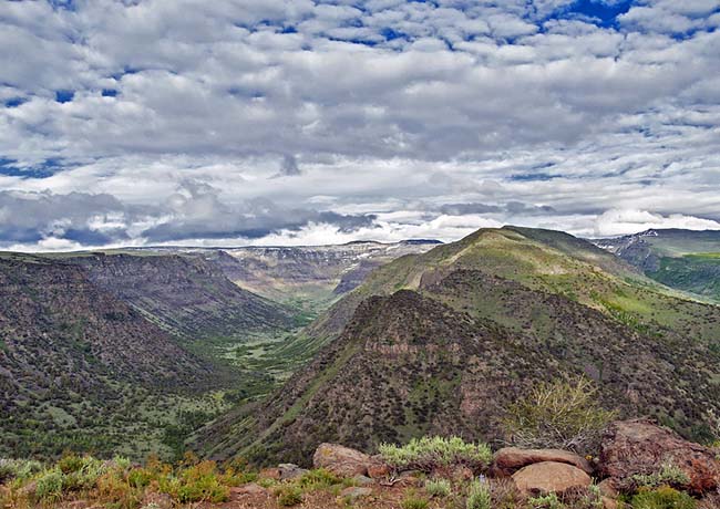
Although Oregon's snow-capped Cascade Range grips the photographer and mountain lover's soul,  you'll have to travel east to the desert region to find the state's highest road. Here in Harney County, Oregon's largest county, the Steens Mountain Loop climbs to a summit that's nearly 10,000 feet in elevation. The 66 mile byway offers one of the most breathtaking thrill rides in the country.
Here on Steens Mountain the summers are short, limiting travel on this alpine byway from July through October. Plenty of wildlife, including eagles, wild horses, elk, deer, bighorn sheep,  pronghorn and an occasional bear or cougar, adds to the already majestic panoramic views. Although the byway's gravel road is suitable for most passenger cars, an eight mile section in the middle will severely test your vehicles endurance. Most believe it's safest to return to Frenchglen the way you came in, skipping the rugged road.
Here in this 170,000 acre wilderness setting expect to see immense glacial-carved valleys, mile high sheer cliffs and crystal clear lakes and streams. Sometimes mistaken as a  mountain range because of its enormity, Steens Mountain is a single fault block mountain that stretches out for nearly 50 miles.
For those coming here for the incredible views, three easy hikes are found along the byway loop from Frenchglen to Steens Mountain. The Steens Summit Trail is an easy hike for a spectacular 360 degree view of Steens Mountain. Short paths also lead sightseers to viewpoints at Kiger Gorge and the East Rim viewpoint.
Byway Map
Area Map

|
Additional Area Attractions |
|
Copyright © 2022 Benjamin Prepelka
All Rights Reserved
