|
Scenic USA - California Upper San Joaquin River |

| Photos by Ben Prepelka Scenic USA FAA Photography |
Divided into two major segments, the San Joaquin River is the longest, and perhaps the most important river in central California. Even as early as the 1700's, the San Joaquin was recognized by native tribes, Spanish and early American settlers as an important watershed for farms and early cities.
The Upper San Joaquin, a boulder strewn stream, carries enormous amounts of mountain sediments, creating some of the most fertile land in Central Valley. Making up nearly a third of the river's length, the middle fork is considered the main branch, starting from Thousand Island Lake at 10,000 feet.
Named for Saint Joachim by Spanish explorer Gabriel Moraga, the San Joaquin River flows through some of the most important agriculture land in America. Here in the San Joaquin Valley, river water continues to be siphoned off, irrigating countless square miles of crop land. Once a land plagued by drought and flood, a string of dams and controls are set up all along the river's 365 mile length.
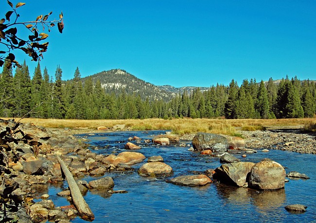
This image was taken nearby Reds Meadow of the Devils Postpile National Monument. Here along the Upper San Joaquin River, anglers find rainbow, brown, brook and golden trout among the grand scenery of the Sierra Nevada Mountains. Once the river leaves Reds Meadow Valley, the river makes a long, sweeping curve from its southward direction and heads west toward the Mammoth Pool Reservoir. Beyond Mammoth Pool and Millerton Lake, the Lower San Joaquin begins its slow meander to the sea. Running northwest through the Great Central Valley farm belt, the river logs another 268 miles.
Area Map

|
Nearby Points of Interest |
Scenic USA Prints from
|
Copyright © 2019 Benjamin Prepelka
All Rights Reserved

