|
Scenic USA - Utah Six Shooter Peaks |

| Photos by Ben Prepelka Ben Prepelka Photography |
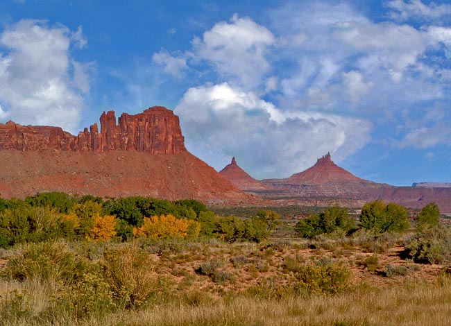
For those who love the desert and Utah's red-rock  country are definitely headed for some of the state's most dramatic scenery as they explore the area from Moab to Blanding. And here in between, Monticello is no exception. Turning off U.S. Route 191 and heading west toward the Needles District and the Canyonlands National Park welcome center, Utah's Route 211 traces the Squaw Flat Scenic Byway. Picking up Indian Creek near Newspaper Rock, the byway continues through a broad stretch of the Greater Canyonlands region. This westerly view shows off an imposing Bridger Jack Mesa and the distant North and South Six Shooter Peaks which top 6000 feet in elevation.
This wide expanse of arid territory falls under protection of the Bureau of Land Management and the National Parks Service. Maintaining public land is a much larger task than anyone can imagine. Besides overseeing road and facility construction, fire and fuels management, and long-range plans, the two bureaus interface  with the public and guard against many unseen threats. Less publicized duties, taking up countless hours, include planning for visitor safety, monitoring of river pollution levels, tracking down pollutant sources, backfilling abandoned mines, studying mining proposals and taking a proactive look for potential trouble spots on public land. These are just a few of the many items on the National Park Service and the Bureau of Land Management's to-do lists.
Area Map

|
More Area Attractions |
Scenic USA Prints from
|
Copyright © 2024 Benjamin Prepelka
All Rights Reserved

