|
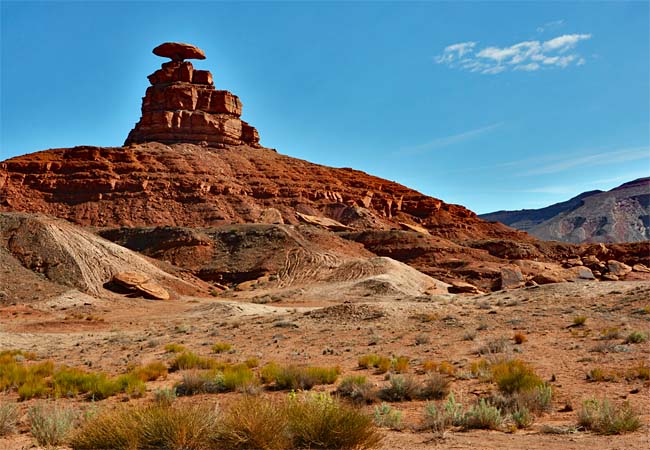
Scenic USA - Utah Mexican Hat Viewpoint |

| Photos by Ben Prepelka Ben Prepelka Photography |
Utah's U.S. Route 163 cuts diagonally across the state's southeast corner and through some of the state's most scenic landscapes. Pictured here is one huge red-rock sombrero, measuring some 60 feet wide and 12 feet thick, giving a name to a nearby town to the south, Mexican Hat. Small town specifically means 88 residents during the 2000 census. Any sombrero larger than this one is well beyond anyone's physical reach.
Small town indeed, but the area around Mexican Hat draws visitors from all over the world. While most sightseers are headed to very famous Monument Valley, a long list of other natural wonders are well worth mentioning. In this enchanting section of the red-rock desert, names such as Goosenecks State Park, Alhambra Rock, Valley of the Gods, Natural Bridges National Monument, Edge of the Cedars, Navajo Twin Rocks, Dark Canyon Wilderness, Hovenweep National Monument, and Muley Point Overlook only add more choices for area's exceptional points of interest. This corner of Utah is just simply packed with a long list of scenic sights to completely fill anyone's trip itinerary.
Area Map

|
Other Area Attractions |
|
Copyright © 2022 Benjamin Prepelka
All Rights Reserved
