|
Scenic USA - South Carolina Bald Rock |

| Photos by Cliff Hamilton Cliff's South Carolina Gallery |
Taking South Carolina's Exit 5 from I-26 as  the interstate nears the North Carolina border, sightseers start off on a beautiful drive along the Cherokee Foothills National Byway. Heading westward, byway travelers will find a half dozen state parks, more than three dozen major waterfalls and what the Cherokees called the "Great Blue Hills of God". Also found in the area, distinguishing the look of South Carolina's Upcountry, is the state’s highest point, Sassafras Mountain, as well as a geological oddity known as the Blue Ridge Escarpment.
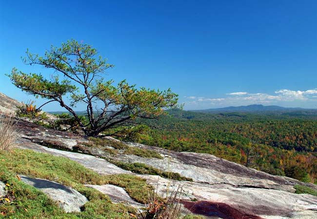
A northwest turn onto U.S. Route 276 at Cleveland climbs the Blue Wall and ultimately leads to Caesars Head State Park, a small section of the Mountain Bridge Wilderness Area. Climbing up to the breathtaking views at Caesars Head, this very steep road uses a never-ending series of switchbacks. Along the way up you’ll find Bald Rock Heritage Preserve a good stopping point. The 165 acre wayside park is a great introduction to the area’s woodlands,  its massive granite monadnocks, and Mountain Bridge Wilderness hiking trails. These granite outcroppings are surrounded by an Upcountry cove-hardwood forest ecosystem. The forest around the Bald Rock includes Monkernut hickory, magnolia, yellow buckeye, cucumber trees, and a wide variety of wildflowers and ferns. Autumn is a glorious time to visit this mountain forest, while eastern hemlocks help keep the area green during the Carolina winter. A popular trail system is woven throughout the Caesars Head and Jones Gap state parks, and the heavily forested Mountain Bridge Wilderness.
Area Map

|
More Area Attractions |
|
Copyright © 2021 Benjamin Prepelka
All Rights Reserved
