|
Scenic USA - Washington Palouse River Canyon |

| Photo by Jim Stiles Jim Stiles Photography |
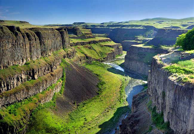
Words arenít adequate to sufficiently describe the powerful forces of flowing water. But here in eastern Washington the scablands of Cheney-Palouse offer a great example of what a massive flood will do. One of the world's most catastrophic ice age events saw incredible amounts of water sweep across the tilted surface of the Palouse,  stripping away hundreds of feet of topsoil, carving up layers of ancient basalt, and creating the area's remarkable coulees and steep-walled canyons.
This view captures the Palouse River Canyon in southeast Washington, an area created by erosional forces long ago. Weaknesses in the Columbia Basin basalt, where lava beds sometimes reach over 6000 feet in depth, gave way to the forces of flood waters. The aftermath is still seen in todayís channeled scablands.
Not all of the Palouse Region is scarred badlands. Rolling hills of beautiful farmland on the Palouse are important for grain production. But here in southeastern Washington the basin-and-butte topography offers an impressive list of dramatic topographical sites. The Palouse River Canyon and Palouse Falls are two of the areaís majestic natural wonders.
Area Map

|
More Area Attractions |
|
Copyright © 2021 Benjamin Prepelka
All Rights Reserved
