|
Scenic USA - Montana North Fork Teton River |

| Photo by Jim Hug Jim's Big Sky Fishing Inset photo courtesy USGS |
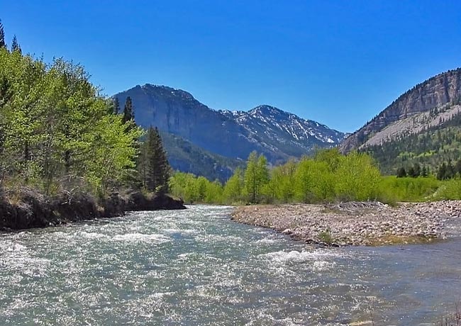
When it comes to Montana's scenery, the big sky and its dramatic mountains command center stage. The Teton River and its upper forks flow through both the Front Range Mountains and the often forgotten eastern plains. The Lewis and Clark National Forest captures both; a large section of the Continental Divide's rocky peaks as well as the foothills and plains that seem to roll on forever. High in the Front Range, headwaters of the upper forks of the Teton gather and begin their easterly flow. Eventually the mountain waters form the Teton River and weave through the high plains for roughly 200 miles, finally emptying into the Maris River.
Pictured here is a scenic view of the North Fork of the Teton River, adorned with a Front Range backdrop. This cold water stream, a 21 mile stretch, was once home to mottled  sculpin, rainbows and westslope cutthroat trout. A series of flood events scoured the river bottom, wiping out the habitats for both trout and their aquatic food sources. Today, the best area for fly fishing traces the Upper Teton River and its branches. Formed in the Bob Marshall Wilderness, these blue-ribbon trout streams offer a rewarding experience with some of the most scenic backdrops imaginable.
For those interested in hiking and backpacking, this remote and isolated area offers the North Fork Teton River Trail. Just west of Choteau, Trail 107 leads to the narrow and winding Box Canyon. The trail crosses the stream in several locations and may be impassable in early spring during high water.
Area Map

|
Additional Points of Interest |
|
Copyright © 2019 Benjamin Prepelka
All Rights Reserved
