|
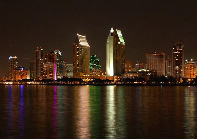
Scenic USA - California San Diego Skyline |

| Photos by Amanda Haddox Amanda Haddox Photography Casa del Prado by Mark Nielsen |
This shimmering reflection  of the San Diego skyline was captured from the shoreline of Glorietta Bay Park. Looking across the huge bay from Coronado, this scene offers some insight about the city's prominence on the waterfront. As one may guess, San Diego's economy relies heavily on the bay, dotted with shipyards, cargo terminals, dry docks and one of the largest naval ports in the world. Tourism, enhanced by the pleasant climate, also takes advantage of the Big Bay. Here, cruise terminals, attractions, restaurants, parks and marinas line the 34 mile scenic shoreline. Just inland, major attractions, including Balboa Park, SeaWorld Park and the San Diego Zoo, contribute to the city's reputation for entertainment and adventure. Museums, theaters, year 'round golf and
  miles of walkable beaches add more reasons for the city's large share of visitors.
Glorietta Bay Park, a small area squeezed between the Naval Amphibious Base and the Aquatic Center, is considered one of the most scenic spots on Coronado Island. Looking west, curious visitors may spot a much different looking San Diego landscape out on the tip of Point Loma and the Cabrillo National Monument. The Cabrillo name honors the first European to set foot on what would become the West Coast of the United States. It was September 28, 1542, when the expedition, led by Juan Rodríguez Cabrillo, landed on the peninsula and looked across the water toward present day Coronado. San Diego's Spanish roots run deep, still recognized in its large Hispanic population, Spanish mission churches, Mexican cuisine, historic districts and countless names of Spanish origin.
Area Map

Copyright © 2023 Benjamin Prepelka
All Rights Reserved
