|
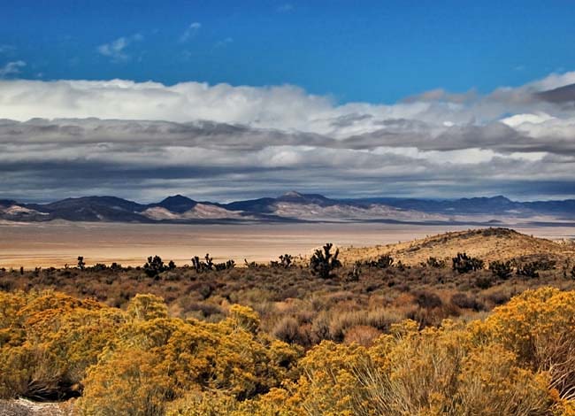
Scenic USA - Nevada Dry Lake Valley |

| Photos by Ben Prepelka Ben Prepelka Photography |
Heading south from Ash Springs on Nevada's U.S. Route 93 (the Great Basin Highway), nearly 100 miles north of Las Vegas, the highway follows broad valleys between state's many barren peaks. It's no surprise that occasionally the highway must make its way over a mountain range, as Nevada is the
most mountainous state in the Lower 48. Cresting a peak near the Pahranagat National Wildlife Refuge, the view ahead catches travelers by surprise with its striking desert beauty. Just ahead the Dry Lake Valley comes into view with swath of bright desert sands. This view takes in a small portion of a 160 square mile valley closed in by the Pahranagat Range to the east and the Delamar Mountains to the west. The valley is covered with a mix of wind blown silt, sandy loam and clay. Seeming to glow in the Nevada sun, the valley paints a strong contrast with the drab, gravelly loam of the mountain slopes. The mountainsides are dominated by the creosotebush, white bursage, littleleaf ratany and brightened with the golden rabbitbrush.
The Dry Lake Valley is heavily influenced by wind and water that constantly shift the valley sands and keeping vegetation from taking root. Accumulating over thousands of years, the alluvium soil has gathered on the valley floor to a depth over a thousand feet.
Area Map

|
Additional Area Attractions |
Scenic USA Prints from
|
Copyright © 2023 Benjamin Prepelka
All Rights Reserved

