|
Scenic USA - Pennsylvania Duquesne Incline |

| Photos by Ben Prepelka Ben Prepelka Photography |
From its early days as a frontier village in western Pennsylvania, Pittsburgh became known as the Gateway to the West.  Here where the Allegheny and Monongahela rivers meet to form the Ohio River, and sitting on top of rich coal deposits, the city became an industrial center, producing half of the steel in the United States. With a large influx of eastern Europeans taking jobs in mining and steel manufacturing, Pittsburgh became the nation's eighth-largest city. Its numerous neighborhoods retained their ethnic character, well represented in their churches and storefronts.
Meeting the growing demand for housing, the Duquesne Heights area of Mount Washington in Pittsburgh began to convert farmland into residential home lots during the mid 1850s. Access to the city was difficult due to the steep hills that rose  up from the Monongahela River Valley. Paths and steps were no longer needed when the Duquesne Incline Plane Company set up a passenger car system on an incline plane. Immigrants who settled on Mount Washington and Duquesne Heights now had easy access to jobs in the city below
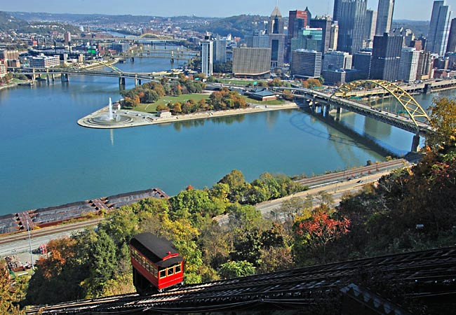
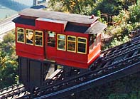
Today only a few inclines remain and are preserved as a tourist attraction rather than a mode of transportation. The incline, pictured here, is owned by the Port Authority of Allegheny County, Pennsylvania, and operated by the
Society for the Preservation of the Duquesne Incline. In the background is a view of the Golden Triangle and Point State Park. The park's fountain water,
stained pink during October, is a reminder for Breast Cancer Awareness.
Area Map

|
Nearby Points of Interest |
Scenic USA Prints from
|
Copyright © 2023 Benjamin Prepelka
All Rights Reserved

