|
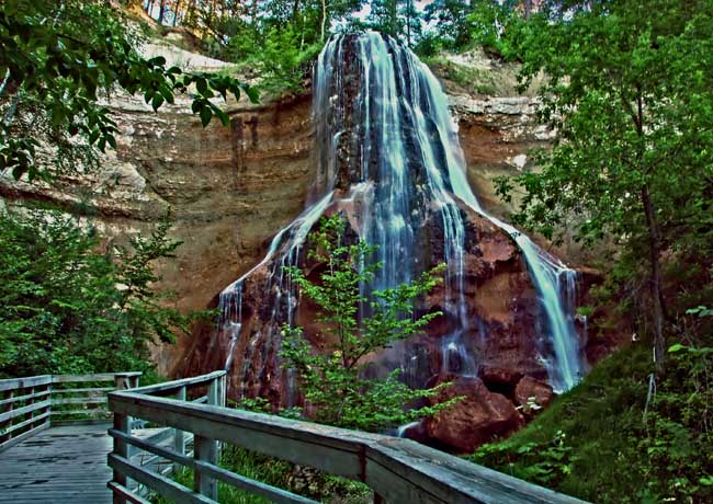
Scenic USA - Nebraska Smith Falls |

| Photos by Ben Prepelka Ben Prepelka Photography |
Developed over time to assist mariners and map makers, the Earth was divided up into imaginary sections by a series of latitude and longitude lines. Latitude lines had a natural starting position at the equator, while all those that established arbitrary north-south lines came to a consensus in 1884. Their agreement made the Prime Meridian, or zero line, run through Greenwich, England.
Now, having an affinity for nice round numbers, the 100th meridian in north central Nebraska conveniently splits the Niobrara River Valley, an area with a most unusual weather zone. Nearly centered in the contiguous United States, dry western air masses collide with humid eastern air along the 100th meridian creating three unique forest and prairie ecosystems. On the wet side, a recent National Park Service study yielded some startling facts.
Yes, it's hard to believe, but Nebraska’s Cherry County, about the size of Rhode Island, has over 200 waterfalls. Although most are small and not that spectacular, Smith Falls drops 63 feet in a semi-circular bridal veil before it runs out to join the Niobrara River. Largest (and tallest) of all Nebraska's waterfalls, the falls and stream create the heart of a popular park, also Nebraska’s newest state park. Located east of Valentine, Smith Falls State Park offers picnic sites, tent camping and canoeing access on the Niobrara River. Another surprise, Smith Falls and neighboring Fort Falls are the only two waterfalls found on Nebraska public land. While a large percentage of Nebraskans leave the state to enjoy America's most popular park-lands, now many are staying home to discover more of the state's scenic wonders.
Area Map

|
Nearby Points of Interest |
Scenic USA Prints from
|
Copyright © 2023 Benjamin Prepelka
All Rights Reserved

