|
Scenic USA - Colorado Colorado National Monument |

| Photos by Ben Prepelka Ben Prepelka Photography |
It's about eight miles from the east entrance of Colorado National Monument to the west entrance ... that is ... as the crow flies. In reality, Rim Rock Drive
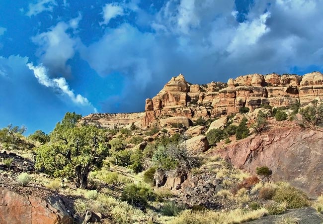
 climbs along a plateau rim for 23 miles, overlooking Grand Valley and the Colorado River. The park road, high above I-70, is loaded with spectacular views of the park's iconic landmarks and deep side canyons. The park road starts to climb immediately past the Grand Junction (east) entrance on the way to the top of Monument Mesa and Devils Kitchen. To the north of the switchbacks at Dogs Tooth lies the Serpents Trail, often called the "crookedest road in the world". At one time the route served as part of the park road until bypassed in 1950. Climbing steadily from east to west, the 100 year old road now functions as one of the park's many hiking trails, a challenging hike just under two miles. Continuing west toward the Fruita entrance, park visitors will pass
  more than dozen overlooks and trailheads. A few trails descend all the way down the 600 foot cliff face into Grand Valley below, passing major rock sculptures, a juniper-pinyon forest and sagebrush flats.
Here in the Colorado National Monument, the rugged, yet spectacular scenery may be enjoyed from many of the short trails and backcountry hikes set up by one man alone ... John Otto. Visitors should tip their hats to John as he pushed for area to be set aside as national park, while building many of the trails long before it became a national monument. Otto's hope was that someday others would enjoy this wonderful landscape and its amazing overhead views of Grand valley and the cities of Grand Junction and Fruita.
Park Map

|
More Area Attractions |
Scenic USA Prints from
|
Copyright © 2024 Benjamin Prepelka
All Rights Reserved

