|
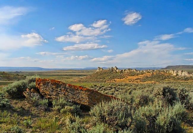
Scenic USA - Wyoming Avenue of Rock |

| Photo by Mark Nielsen Independence Rock.org |
As American pioneers made their way westward during mid 1800s, one of the most popular travel routes covered 250 miles from Fort Laramie to central Wyoming's Shining Mountains to South Pass. During a 30 year span covered wagons with iron rimmed wheels carved deep ruts into a trail along the North Platte and Sweetwater rivers. This part of the Oregon Trail accrued a half dozen names, varying from Forty-Niners' California Road to the Mormon Trail (named for the thousands of Brigham Young followers).
This view features a landmark along the Oregon Trail, the Avenue of Rock (Rock Avenue or Devilís Backbone). Found just west of Casper, Wyoming, permanent trail grooves and pioneers' inscriptions remain from one of the greatest overland migrations the country has ever seen. This section of trail between the Platte and Sweetwater Rivers was marked by an arid prairie and alkali water, making the route through Poison Spring Creek Valley one of the most challenging segments of the journey.
Area Map

|
More Area Attractions |
|
Copyright © 2024 Benjamin Prepelka
All Rights Reserved
