|
Scenic USA - Hawaii Road to Hana |

| Photos by Ben Prepelka Ben Prepelka Photography |
Known as the Valley Isle,  Maui was named for a demigod who lifted all the Hawaiian Islands from the sea with a magical fishhook, choosing to make Hawaii's second largest island the most beautiful. Dominated by the 10,200 foot tall Haleakala crater (House of the Sun - the world's largest dormant volcanic crater), Maui's land mass is largely made up of two volcanoes. Following a must-do tradition (at least once), visitors drive to the top of Haleakala Peak to watch the sunrise.
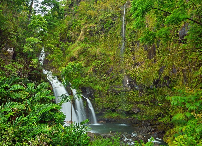
Another traditional Maui adventure takes in a scenic drive along the cliff-hugging Hana Highway. Beginning at the town of Kahului, Route 36 runs along the northern coast and around to the eastern town of Hana. Designated a Millennium Legacy Trail in 2000 by President Bill Clinton, this scenic route encounters over 600 curves, 46 single lane bridges and 18 major waterfalls. By Hawaiian standards  the Upper Waikani Falls are small, but a five minute walk from a highway pullout, just beyond mile marker 19, leads to this picturesque setting. Also called Three Bears Falls, this trio reminded its residents of papa, mama, and baby bear.
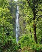
While some waterfalls are on private property, guidebooks will always include the 'Ohe'o Gulch waterfalls (inset - Kuloa Point Trail) and Waimoku Falls, located within the Haleakala National Park. Visitors may hike the four mile (round trip) Pipiwai Trail which climbs along  the Pipiwai Stream, highlighting more of the Seven Sacred Pools in (Oheo Gulch - Oh-Hey-Oh), the beautiful 185 foot Makahiku Falls, several smaller step falls, a unusual section of thick bamboo forest, and ending at the dramatic 400 foot Waimoku Falls.
The 68 mile Road to Hana may take up to three hours to drive, but its lush tropical settings and breathtaking blue Pacific vistas will keep sightseers busy the entire day. Passengers who get carsick may want to take the front seat where it seems to have a lessening effect on motion sickness. The road is tight and curvy, so the driver must focus on the highway instead of the gorgeous scenery.
Travel notes: Keep in mind there are local residents and day workers who use Hana Highway - sightseers please be courteous to faster traffic.
A smartphone app (70.8 MB), called GyPSy Guide GPS Driving Tour, is an incredible way to enjoy a self-guided tour ... knowing exactly where you are on the Hana Highway and pointing out just about everything you would want to see and the details behind each stop.
Area Map

|
More Area Attractions |
Scenic USA Prints from
|
Copyright © 2024 Benjamin Prepelka
All Rights Reserved

