|
Scenic USA - Nevada Great Basin Scenic Byway |
| Photos by Ben Prepelka Lehman Caves - NPS Ward Ovens - Gary O'Toole |
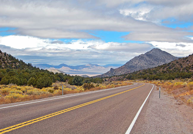
The Great Basin Scenic Byway stretches across Nevada's high desert from the city of Ely southward to Crystal Springs over U.S. Route 93 and then returning to Ely over Nevada's Route 318. 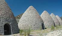 The scenic loop connects byway travelers to seven state parks, a handful of the state's old mining towns and the Great Basin National Park. It takes two short side trips from the loop to see the diverse Great Basin National Park and the state's Echo Canyon and Spring Valley parks.
Here at the Great Basin National Park, once thought as a hot dry and barren wasteland, diverse plant and animal communities thrive. The pinyon pine was the first tree adopted as a state symbol, 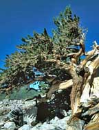 but Nevada students lobbied for the bristlecone as the state tree. The bristlecone pine is one of the oldest trees in the world. It seems the harsher conditions, the longer the tree lives, with some trees reaching 4000 years old.
Despite the desert environment, the Great Basin Area supports 11 species of conifer, 73 mammal species, and barely believable, eight species of fish. With an elevation difference of 8000 feet between Wheeler Peak and the desert floor, the Great Basin National Park contends with huge temperature swings that create very different ecosystems.
The byway journey also doubles as a Nevada lesson in history. Gaining statehood in 1864 and ensuring Lincoln with three more electoral votes, Nevada's population explosion was due to the great silver strikes beginning in 1858. Mining towns sprouted up like weeds 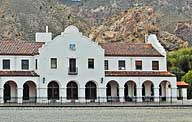 and tales of fabulous fortunes brought in more and more prospectors. Some of these towns continued on after the mines ceased, only as stops for the railroad. Many gave way to the elements, and are visited today by the curious and wind-blown tumbleweed.
While Cathedral Gorge is both a historic and recreational stop, other nearby state parks are known for backpacking, camping, fishing and sightseeing. Here in Nevada's only national park, Wheeler Peak sets the tone for the Great Basin Park. Topping 13,000 feet, the mountain is the state's second highest. And that is really saying something as Nevada is one of the most mountainous states in America. One of the big surprises in the park may be the spectacular Lehman Caves. A beautiful marble cave, discovered in the late 1800s, is decorated with stalactites, stalagmites, 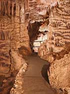 helictites, flowstone, popcorn and rare shield formations. Declared a National Monument in 1922, the National Park Service took over in 1933. Work, clearing out decades of litter, repairing broken formations and installing a user friendly access, fell to several Depression Era New Deal agencies.
Small towns dot the byway, and Panaca claims to be the second-oldest town in Nevada. In Caliente, byway visitors will only find traces of the powerful Union Pacific Railroad. Here an old mission-style depot served the railway and doubled as a hotel. Today the depot houses city offices, an art gallery and library.
At Pioche, home of the Million Dollar Courthouse, travelers will discover a mining town that was once home for 10,000 people. Covering over 300 miles, and taking about 5 hours to drive it, the byway will require a few days of travel to thoroughly enjoy the highlights.
Byway Loop Map

|
More Area Attractions |
Scenic USA Prints from
|
Copyright © 2024 Benjamin Prepelka
All Rights Reserved

