|
Scenic USA - Colorado Ute Pass |

| Photo by Paul Winters Paul's High Country Aerie Blog |
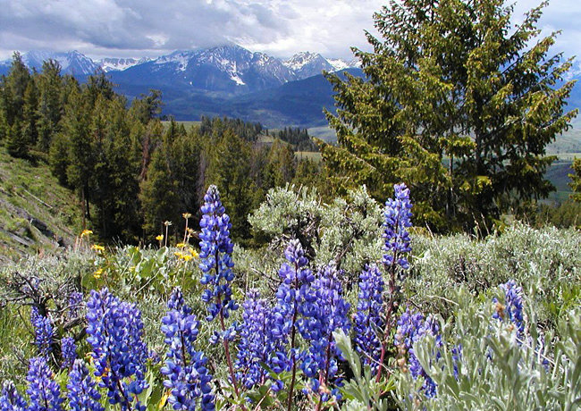
Late spring is a colorful time of year in the Colorado Rockies. The snow has cleared from mountain passes, melting snowpack feeds sparkling mountain streams, green grass and wild flowers cover alpine meadows and springtime aspens put on a new coat of delicate leaves.
Heading west from the famous Pikes Peak and the city of Colorado Springs, Route 24 passes a string of small towns as it winds its way toward the Pike National Forest. The town of Divide fittingly marks Ute Pass, named for a Native Tribe who repeatedly migrated from the prairie to the mountains. At 9500 feet, this summit is only a moderate climb in comparison to Colorado's exceptionally high mountain passes.
Following the well worn Ute Trail, 1860s miners and prospectors widened the route to move wagon loads of supplies to the mining camps of Leadville. Eager to furnish rail service to the area, the Colorado Midland Railway also ran its tracks through Ute Pass.
Today the railroad tracks are gone, replaced by a modern highway. It's still a remarkable drive, as witnessed in this Ute Pass view. Tourism has flourished here in this mountain setting since the late 1800s. With the Gore Range in the background, this bright patch of lupine enjoys the dry sunny slopes of Ute Pass. After a lengthy winter, it's time to stretch your legs and enjoy this view in the Colorado mountains.
Area Map

|
Additional Area Attractions |
|
Copyright © 2022 Benjamin Prepelka
All Rights Reserved
