|
Scenic USA - Montana Missouri Breaks |

| Photos by Jim Hug Jim's Big Sky Fishing |
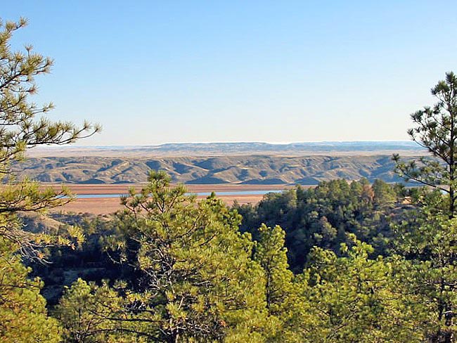
North-central Montana, sometimes called Russell Country, is viewed as the real West where famed cowboy artist Charlie Russell loved to paint. This is the land explored by Lewis and Clark. Much of the land, unchanged over the last 200 years, is marked by a rumpled landscape of grassy plains and hills, buttes and the broad Missouri River Valley. The most spectacular section of the river valley is the White Cliffs, where perpendicular cliffs rise to 300 feet.
The Upper Missouri Breaks National Monument encompasses 377,000 acres east of Great Falls and borders Russell National Wildlife Refuge. This section of the Missouri River courses through the  Montana badlands, designated as a Wild and Scenic River in 1976. Simply called The Breaks by locals, this view still retains the appearance of unspoiled Indian Territory. During the late 18th century, some of the first Anglo fur trappers encountered Northern Cheyenne, Sioux, Crow, and the plains Cree and Ojibwa tribes.
Today, the monument's land use problems have been dropped into the BLM's lap. In this relatively new parkland, created in 2002, problems linger with balancing over-grazing and attempts to keep local economies afloat. Free range cattle have greatly reduced woody shrubs and trees, so important to natural wildlife. The small cottonwood trees along the river banks have been repeatedly trampled, leaving no replacement trees.
One of the bright spots for the area is tourism. Whether its avid hunters seeking a trophy elk, anglers searching for a trophy trout, weekend float trips, or sightseers traveling the Missouri Breaks Back Country Byway, Russell Country is a vast, untamed land just waiting to be explored.
Area Map
Monument Map

|
Additional Points of Interest |
|
Copyright © 2020 Benjamin Prepelka
All Rights Reserved
