|
Scenic USA - Virginia Old Point Comfort Light |

| Photos by Ben Prepelka Ben Prepelka Photography |
When Captain Christopher Newport's crew rowed from the Susan Constant to the tip of today's Delmarva Peninsula and  gazed upon a comforting safe harbor, little did they know this would become one of the most important seaports on the eastern seacoast. Isolated from the surging Atlantic Ocean, the crew named this area Cape Comfort.
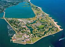
A lot has changed since Newport's arrival in 1607. This strategic point has housed Colonial Fort George, the 1830s Fort Monroe and witnessed a Civil War sea battle. Directly seeing the importance of the area after the War of 1812, Old Point Comfort was transformed into the largest stone fort built in the United States.
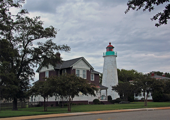
During the War of 1812, The Old Point Comfort Lighthouse fell into the hands of the British. Using the lighthouse as an observation post, the British moved on to Washington DC and set the capital city ablaze.
While most lighthouses were damaged or destroyed during the Civil War, the 54 foot Old Point Comfort Lighthouse remained intact under Union control.  Even though the famous battle of the ironclads unfolded just offshore, the lighthouse was never harmed. Better known for its two opposing warships, the CSS Virginia (Merrimack) and the USS Monitor, the Hampton Roads battle was said to end in a draw.
Today, Fort Monroe has been transformed again. This time the National Park Service invites visitors to enjoy the history at Fort Monroe National Monument. Walking tours introduce guests to the fort, the Casemate Museum and the Old Point Comfort Lighthouse. Spanning the periods between the 17th and the 21st centuries, Fort Monroe is an essential stop for any history buff.
Area Map
Directions to Fort Monroe

|
More Area Attractions |
Scenic USA Prints from
|
Copyright © 2024 Benjamin Prepelka
All Rights Reserved

