|
Scenic USA - Ohio Covered Bridge Scenic Byway |
| Photos by Ben Prepelka Ben Prepelka Photography |
Between Graysville and Marietta, Route 26 snakes its way through Monroe and Washington Counties as Ohio's Covered Bridge Scenic Byway. The highway parallels the Little Muskingum River, mirroring a lot of the river's twists and turns.  Like a scavenger hunt, ten points of interest are scattered over the length of this 44 mile route. Four covered bridge sites, historic buildings and recreation areas in the Wayne National Forest are found along the highway.
Heading southward from Graysville, the first stop on the byway isn't a covered bridge, but here byway travelers will find the 19th century Lamping Homestead site. The rec area features picnic sites, foot trails and a primitive camping area.
Stop number 2 on the byway leads sightseers to the site of Ring Mill. Walter and Margaret Ring first purchased a parcel of land in Monroe County in 1840. Their stone home quickly followed and still stands today.
The third stop, at one time, featured the Knowlton Covered Bridge (35-56-18). 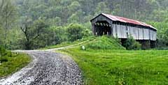 The bridge was off to the east on a gravel side road (CR 387A), but gave in to gravity on July 5, 2019. One of Ohio's longest, it took three spans to stretch over the Muskingum River. The old relic was built in 1887, and was added to the National Register of Historic Places in 1980. The reconstruction of the Knowlton Covered Bridge was completed and reopened to traffic on January 12, 2024. The 3.2 million dollar restoration project was the work of Rider Construction.
Crossing the county line, the next stop on the Covered Bridge Scenic Byway is a Washington County bridge. Interestingly, the Rinard Bridge has already used up four of its nine lives. The original covered bridge was built in 1871, and lasting only five years, the bridge was destroyed in a flood. 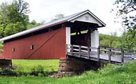 The Smith Bridge Company constructed a new bridge using the patented Smith truss system. The bridge was tested in 1913 and 1938. Twice washed downstream, the trusses were numbered, then dismantled and then reassembled on the original piers. Again, during a flood of 2004, the bridge was washed from its foundation and remained intact downstream, only to be ripped apart a few weeks later during a successive flood. Timbers and trusses were salvaged by the Righter Company and the reconstructed bridge was able to hold on to its National Register designation.
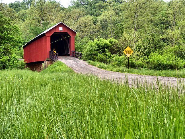
The one lane Hune Covered Bridge (main photo) is next up, along with a historic inn. The Hune Inn, an area landmark for over a century, took in boarders beginning in the late 1800s. The Hune Bridge (35-84-27) looks in fine condition after its 1998 refurbishment, surviving floods in 2004 and 2005. 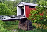
The next two stops include an old country store and a Mail Pouch barn. Truly a convenience store, the Meyers Store was once the only store on a 44 mile stretch of Ohio's Route 26. Initially called the Wingett Run store, during the 1890s it was the only place to pickup mail or make a phone call. The Mail Pouch barn is among some of the last barns bearing the work of famous Belmont County resident Harley Warrick.
The last stop on the byway (first if you're starting from Marietta) is the Hills Covered Bridge (25-84-24). Just five miles from Marietta, watch out for the Hills Bridge Road (CR 333) to the east. The 1878 span was built by the Hocking Valley Bridge Works and added to the National Register of Historic Places in 1978.
Although it may take only an hour to drive this route, count on spending most of the day to enjoy this romantic byway. Camping and 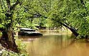 canoeing along the Little Muskingum creates an excellent weekend trip. With gentle class I waters, a canoe trip on the Little Muskingum River offers a fun family adventure when there's enough water. The Wayne National Forest Service has established campgrounds and canoe launch sites along the riverbank. Not up to a weekend paddle, enjoy the byway's leisurely pace, the four wishing bridges and area history.
Byway Map

|
More Area Attractions |
Scenic USA Prints from
|
Copyright © 2025 Benjamin Prepelka
All Rights Reserved

