|
Scenic USA - Texas Palo Duro Canyon |

| Photos by Ben Prepelka Lighthouse inset photo - Wikipedia |
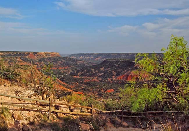
Billed as the second largest canyon  in the United States, Palo Duro Canyon was carved out of a Caprock Escarpment in the Texas High Plains by a relentless Prairie Dog Town Fork of the Red River. Varying in estimates from 70 to 120 miles long, the canyon reaches depths of 800 to 1000 feet. Often referred to as the Texas Grand Canyon, Palo Duro is located about an hour's drive from Amarillo and the I-40 corridor. Increasing in size over the years, Palo Duro Canyon State Park takes in over 16,000 acres of land surrounding the canyon. Here in the Texas Panhandle, towering cliffs, steep mesa walls, and bands of red, yellow,
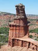
  purple and white sandstone provide the backdrop for exciting park adventures. Whether it's following the 16 mile scenic drive through the park, biking, horseback riding, nature studies or bird watching, there is plenty to do. There are also many caves, hoodoos and trails to explore. The 75 foot sandstone/shale tower known as the Lighthouse is one of the park's most popular destinations, attracting hikers, mountain bikers and equestrians on a five mile roundtrip.
The Palo Duro Canyon State Park, just east of I-27, opened in 1934 months before it was completed. Thanks to initial efforts of the Civilian Conservation Corps, the main park road, canyon access trails and park infrastructure remain today. The Canyon Rim Visitor Center is a fine example of Depression Era construction, displaying an exterior of rustic native stone and lumber. Before the park road was completed, Corps workers had to hike in and out of the canyon over the CCC Trail.
Area Map

|
More Area Attractions |
Scenic USA Prints from
|
Copyright © 2025 Benjamin Prepelka
All Rights Reserved

