|
Scenic USA - Montana Mill Creek Road |

| Photos by Paula Krugerud Paula Krugerud Photography |
Mention the name Anaconda, and first  thoughts may gravitate to one of the largest snakes in the world, and most likely not one of the world's largest copper mines. Well, you'll soon learn that this Montana mine helped to string America with miles and miles of copper wire during initial years of the telegraph and telephone. Amazingly the Anaconda mine produced more than 300 million dollars worth of metal during its lifespan.
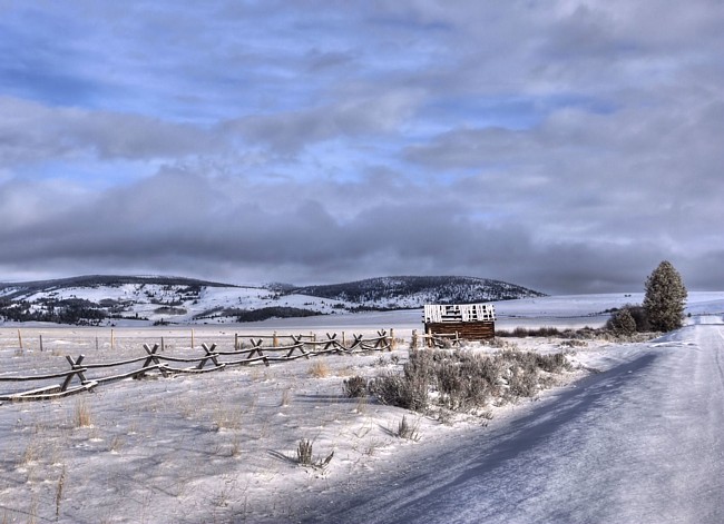
For Montana sightseers, the city of Anaconda is considered the gateway to the Pintler Wilderness Area, Lost Creek Falls, Lost Creek State Park and the Big Hole National Battlefield. Pictured here is a frosty winter scene from a western Montana backcounty byway that the follows Mill Creek Road. Taking CR-569 (Mill Creek Rd) from Route 1 in Anaconda, this scenic route crosses the Continental Divide and passes by the 56,000 acre Mount Haggin State Wildlife Management Area. Bordering on the Deer Lodge-Beaverhead National Forest, this byway leads through miles of rugged and remote big game country. Offering a  link between Highway 1 and Route 43 (and the Big Hole River), sightseers will enjoy this leisurely drive where state management lands are home for elk, white-tailed and mule deer, moose, coyote, wolves and pronghorn. Making a dramatic recovery from un-tempered early 1900s fur traders, mink, muskrat, beavers and black bears are now common. For birdwatchers, raptors, songbirds and waterfowl are year round residents. When the signs of spring approaches and the snow has melted, mountains meadows are found decked-out in myriads of brightly colored wildflowers. With a dramatic Anaconda Mountain Range as a backdrop, this scenic backcountry byway is well worth tracking down.
Area Map

|
Additional Points of Interest |
|
Copyright © 2024 Benjamin Prepelka
All Rights Reserved
