|
Scenic USA - California Grizzly Falls |

| Photos by Ben Prepelka Ben Prepelka Photography |
The majority of Kings Canyon parkland surrounds one of the deepest canyons  of the United States and harbors some of the tallest peaks of the Sierra Nevada Mountains. Kings Canyon National Park covers 460,000 acres of rugged land, graced with majestic alpine ridges, glacially scarred basins and a variety of beautiful alpine lakes.
Aside from the Grant Grove section of the park, only one access road leads into the canyon, leaving most of the park only accessible on foot or horseback. Sometimes compared to its northern neighbor (Yosemite) in its landscape, the remote setting of Kings Canyon and its winding access road (SR 180) limits visitation and Yosemite-like overcrowding.
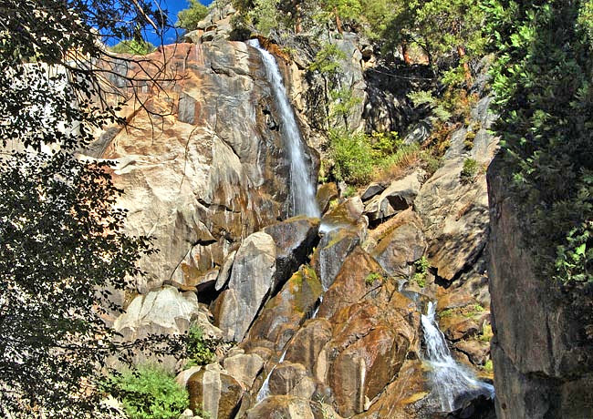
Although technically part of neighboring Sequoia National Forest, the Grizzly Falls Picnic Area is found on the roadside of Kings Canyon Highway (SR 180). A great location to stop and have a picnic lunch, the 80 foot falls creates a beautiful backdrop. Pictured here, Grizzly Falls has slowed to a thin ribbon in late fall. Until late, the waterfalls usually puts on an impressive roar during late spring and early summer.
Over the past few years, California has experienced rising temperatures and severe drought conditions. Warmer temperatures have encouraged tree growth up the slopes of Kings Canyon, and now more and more plants soak up precious moisture, resulting in less water for the Kings River. Here, lack of water in area waterfalls cannot compare to the state's problems in supplying water to the agriculture community.
Area Map

|
Nearby Points of Interest |
Scenic USA Prints from
|
Copyright © 2022 Benjamin Prepelka
All Rights Reserved

