|
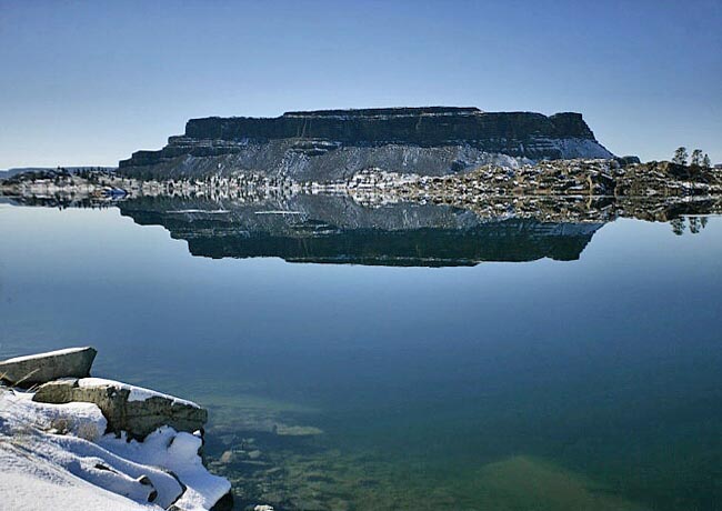
Scenic USA - Washington Steamboat Rock |

| Photo by Terri Steele Terri Steele Photography |
Like a massive roadblock, Washington's Cascade Range prevents a huge amount of moisture from leaving the Seattle area. On the east side of the mountains, especially in the Columbia Basin, the meager rainfall averages less than twelve inches a year. In a land shaped by a number of cataclysmic events, an unusual landform, called the Grand Coulee, stretches out for nearly sixty miles. This ancient river bed is now part of the Columbia Basin Project, a series of reservoirs, canals, and pumping stations. The upper Grand Coulee was dammed, and now over 600,000 acres of farmland are irrigated with water from Banks Lake. Viewed as one of the largest water conservation projects in the United States, the series of reservoirs has created a variety of side benefits. This string of lakes has converted this arid region into an enormous haven for wildlife and wide array of recreational areas.
One of the surviving landmarks in the area, Steamboat Rock rises 800 feet above Banks Lake. This king-size basaltic butte, covering 600 acres, lends its alluring name to a surrounding Steamboat Rock State Park. With nearly 10 miles of shoreline on Banks Lake, you may guess this is the place for a weekend get-away and summertime fun. The crystal blue waters offer a striking contrast to the drab gray surrounding scablands, calling in swimmers and boaters during the hot days of summer. Offering protection from the basin winds, a long line of poplar trees mark the park's campgrounds. Park goers with itchy feet may follow several trails to the broad, flat top of Steamboat Rock. Once on top of this huge butte, a large plateau covered in grasses and wildflowers, climbers find panoramic views of the state's vast scablands and nearby Electric City.
Area Map

|
More Area Attractions |
|
Copyright © 2020 Benjamin Prepelka
All Rights Reserved
