|
Scenic USA - Connecticut Diane's Pool-Natchaug River |

| Photos by Ben Prepelka Ben Prepelka Photography |
Ideally, Connecticut's Water Trails Program not only provides river access points, but a way to encourage land preservation and good waterway stewardship. Offering a unique perspective, sitting on the water, water trail users may rediscover the joys and adventure of paddling. Following traditional corridors where Native Americans traveled for centuries, the American Canoe Association has recognized and designated a network of eligible water trails.
The Natchaug River is formed near Eastford, where the Bigelow Brook and Still River join. Paralleling Route 198, the Natchaug flows southward through Windham County to Mansfield Hollow Lake. As the river briefly runs through the Natchaug State Forest, crowds gather for swimming,  picnicking and whitewater rafting, taking on Class II to IV rapids.
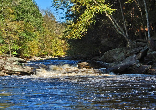
Very different from a slow moving alluvial channel, this view of the Natchaug shows its surge over solid bedrock steps and into a deep pool. One of a series of nine pools along the Natchaug nearby the town of South Chaplin, Diane's Pool is the largest. Although it's a short mile trip, the run is popular among river paddlers. In the summer, it becomes a favorite swimming hole for the locals. Officially there's no swimming at Diane’s Pool, but with its inviting clear pool, smooth granite riverbanks and a cozy setting surrounded by huge boulders, it's a natural place to cool off during the hot days of summer.
Directions and Legend of Diane's Pool
Area Map

|
More Area Attractions |
Scenic USA Prints from
|
Copyright © 2019 Benjamin Prepelka
All Rights Reserved

