|
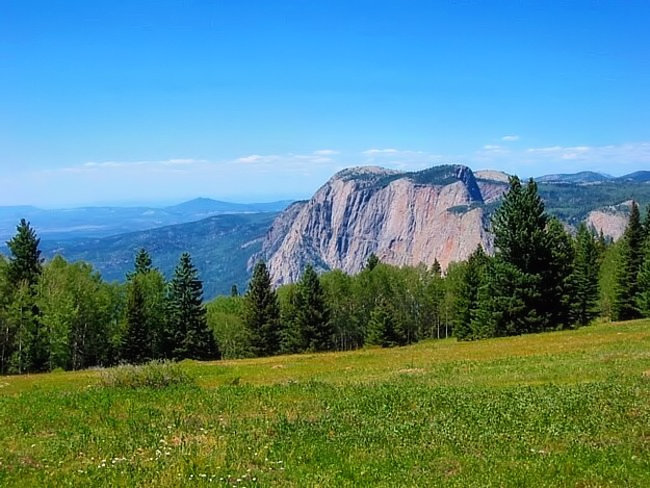
Scenic USA - New Mexico Brazos Cliffs |

| Photo by Roger Gillette |
Here in northern New Mexico the San Juan Mountains makes up a portion of the southern Rocky Mountain Range, covering 10,000 square miles. Local peaks nearby Chama are part of the Tusas Mountains. This barrier ridge is so tall, reaching 11,000 feet, it often blocks winds and storms from reaching the eastern Great Plains.
The Brazos Cliffs, just south of the Colorado border, are made up of some of the oldest rock found in New Mexico dating back 1.8 billion years. Mainly a tough, weather resistant rock, these mountains are commonly rounded with light gray peaks. Made up primarily of Precambrian quartzite and plutonic rock, the cliffs rise upward from their base over 2000 feet.
This view of the Brazos Cliffs is seen from Route 64, heading east from Tierra Amarilla. The high point of the range is on Grouse Mesa where Brazos Benchmark tops out at 11,405 feet. To the southeast is a more distinctive Brazos Peak. Here the cliffs begin to gradually fade in height, with the Encinado Wedge reaching only 1000 feet. With all this bare rock exposed, there's no doubt it has enticed many avid rock climbers. In fact the first technical climb was made by George Bell back in 1952. For the next 20 years George and Ginny Bell explored the entire area. During this period a group of Los Alamos Mountaineer members established 45 routes among these cliffs. Unfortunately for climbers the Brazos are now off limits, located on private property.
Los Ojos, the springs, is located at the base of the cliffs. The small ranching community was settled in 1860 and was one of the first permanent settlements in the area. Continuing east, Route 64 winds through the Carson National Forest and on to a well preserved, Taos Pueblo, established before the 1400s.
This entire area, filled with spectacular mountain views and dozens of historic landmarks, can keep sightseers busy for days.
Area Map

|
More Area Attractions |
|
Copyright © 2025 Benjamin Prepelka
All Rights Reserved
