|
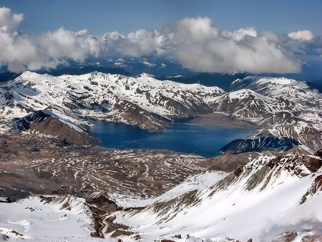
Scenic USA - Washington Spirit Lake |

| Photos by Eric Noel Eric's Mount Saint Helens Gallery |
America's Cascade Range contains 15 subduction related active volcanoes, with the last eruption occurring on Mount St. Helens. Quite active over the last 4000 years, the May 18th, 1980 eruption reduced the mountain's height by 1300 feet and spewed out more than 23 square miles (3.3 billion cubic yards) of its mountainside in the blast. A lateral explosion unleashed a fan shaped mixture of ash, mud and shattered timber at incredible speeds. This hot, steaming avalanche of debris, reaching 300 mph, covered a distance of 19 miles, taking out roads, bridges, railroad tracks and homes, killing 61 people.
The largest landslide in recorded history turned the nearby Spirit Lake into a steamy, toxic sludge pond,  killing all air-breathing life forms. After 35 years, Spirit Lake is well on its way to recovery. Although the lake is no longer the same dimension or depth, it is filled with life. Washington’s constant precipitation began to flush the lake, improving water quality enough to allow the beginning growth of phytoplankton and tiny aquatic species. Congress established an 110,000 acre Mount St. Helens National Monument to preserve the blast zone for scientific study and its thousands of curious visitors. Roads and bridges have been rebuilt, along with a visitor center and hiking trails. Just four miles from the crater and south of Randle, Washington, Forest Road 99 leads to Windy Ridge. Here, from this grand viewpoint, visitors look down to Spirit Lake and the recovering mountain slopes of Mount St. Helens.
Area Map
Footage of MSH Eruption

|
Additional Area Attractions |
|
Copyright © 2022 Benjamin Prepelka
All Rights Reserved
