|
Scenic USA - California Mount Lassen |

| Photos by Ben Prepelka Ben Prepelka Photography |
California's Mount Lassen is primarily known for its recent volcanic geology. The last major eruption in 1915 is well documented, and the area's boiling springs, mud pots and steaming fumaroles suggest this southern Cascade Mountain is still located on an active hot spot. Mount St. Helens and Mount Lassen share the distinction of the only two Cascade volcanic eruptions during the 20th century in America.
Lassen Peak, centerpiece of today's Lassen Volcanic National Park, awoke from a 27,000 year old slumber  at the start of the 20th century, spreading volcanic ash in a 200 mile radius. A series of eruptions occurred from 1914 through 1917, with the big one coming in 1915 that blew out a 1000 foot wide crater near the summit of Lassen Peak. The pyroclastic flows doused a three mile area with chunks of hot lava and ash. Hot avalanches transformed snow layers into highly fluid lahars, creating a 10 mile path of destruction.
Today, you find the park's unique geological features through a series of hiking trails. These trails may also lead to some of the park's 700 different flowering plant species, as well as a wide variety of wildlife habitats. Park elevations vary from 5000 to 10,000 feet. And with unequal amounts of precipitation and diverse soil types throughout these different elevations, a wide variety of environmental niches have been created.
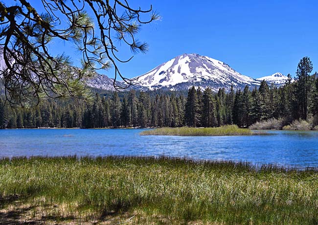
This view of Mount Lassen, shaking off the frigid temperatures of a long winter, was taken from the Manzanita Lake Trail. More than 50 wilderness lakes are spread throughout the park, named by early pioneers who followed trails blazed by William Nobles and Peter Lassen.
Area Map

|
More Area Attractions |
|
Copyright © 2022 Benjamin Prepelka
All Rights Reserved
