|
Scenic USA - South Dakota Badlands Scenic Drive |

| Photos by Rick George |
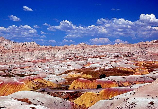
A stark Dakota landscape, considered unsuitable for ranching and farming, had been home for Native Americans for thousands of years. Early French fur traders called it mauvaises terres, and ever since it's been "the badlands". Today, a visitor's first glance may agree with the old badlands reputation, but after a careful look many realize this semi arid prairie grassland is a complex community of plants and animals. Anchored by 56 species of grasses, the badlands provide habitat for grazing animals and their predators. The Great Sioux Nation, specifically the Oglala Lakota, lived in the Badlands region for 150 years. The Lakota hunted small game and found the Badlands Wall a convenient lookout, a high ridge to spot their prey. By the late 1800s, the Natives were moved to reservations just to the south.
In this endless landscape of high ridges, crumbling buttes and eroded canyons, nearly a quarter of a million acres were established as a National Monument in 1939. The nearby Stronghold District of Badlands National Park was  converted to a practice bombing range in 1942, and the Oglala Sioux were moved again. Today the area is littered with corroded shells and unexploded ordnance, giving a new meaning to the word badlands. Clean-up efforts remain an ongoing project.
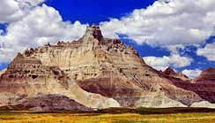
This colorful Badlands view, found along the Badlands Loop Road, shows off one of the region's many picturesque buttes and pinnacles. One of the easiest ways to experience the badlands is along the park roads, including the unpaved Sage Creek Rim Road. While there are over a dozen overlooks and scenic viewpoints, only a few marked hiking trails near the Ben Reifel Visitor Center allow guests to explore the area on foot. Because sixty-four thousand acres of Sage Creek are designated official wilderness, it's best to explore the land on marked trails. The topography is treacherous here and some novice hikers become disoriented in the jumbled terrain without any major reference points.
Formed inch by inch over a very long period of time, Earth's early animals were buried by periodic floods in the badlands. The same prairie wind, rain and frost, responsible for the topography, are also the forces that uncover Eocene and Oligocene fossils. These
fossilized mammals continue to peek through the Pierre Shale within Badlands National Park. Because of the vast number of fossilized remains here in the park, scientist have dubbed the Oligocene Epoch as the "golden age of mammals".
Area Map
Directions

|
Additional Points of Interest |
|
Copyright © 2020 Benjamin Prepelka
All Rights Reserved
